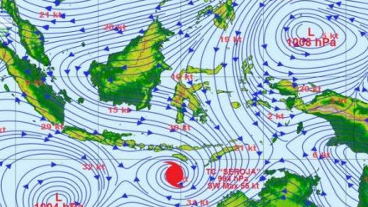
JAKARTA - The Bureau of Meteorology, Climatology, and Geophysics (BMKG) said the presence of tropical cyclone seeds 94W around the Western Pacific north of Papua was observed on Monday, April 12.
With the cyclone seeds, the BMKG reminds the public to be aware of flooding.
"On April 12, 2021 (07.00 a.m. local time) formed seeds of tropical cyclone 94W around the Western Pacific north of Papua, precisely -5.8 LU -141.1 BT which is included as a monitoring area TCWC Jakarta", said Deputy Meteorologist of BMKG Guswanto, in a press release, Tuesday, April 13.
Guswanto explained that the minimum pressure of tropical cyclone seedlings 94W reaches 1.007 hPa, with maximum wind speeds around the system reaching 37 kilometers per hour.
SEE ALSO:
Meanwhile, Himawari Satellite Imagery-8 infrared channel shows significant convective cloud growth in the last 6 hours.
"The 94 W seedlings are in a supportive environment with warm sea surface temperatures (29-30 degrees Celsius), weak lower level convergence (10-20s-1), moderate top layer divergence (20-30s-1), weak vertical shear (5-10kt), and moderate lower layer vorticity. The circulation of this system is detected in the lower layer to the middle layer (925-500 hPa)", he said.
Nevertheless, according to Guswanto, circulation still appears to widen, especially in layers of 850 hPa and 700 hPa. The global scale model suggests these seeds will propagating to the northwest as the intensity increases.
"The potential for 94W to reach tropical cyclone intensity in the next 24 hours is in the moderate category", he said.
Guswanto said that the potential for heavy intensity rain in the next 24 hours can be accompanied by lightning and strong winds in East Kalimantan, North Kalimantan, North Sulawesi, Gorontalo, Central Sulawesi, West Sulawesi, South Sulawesi, Southeast Sulawesi, North Maluku, West Papua, and Papua.
"Areas with alert levels for potential floods/flash in the next two days based on impact-based forecasts are North Sulawesi and North Maluku", he said.
Wave height of 1.25-2.5 meters, Guswanto continued, is likely to occur in the central and eastern Sulawesi Sea, the northern waters of Sangihe Islands to Talaud Islands, Maluku Sea, northern and eastern waters of Halmahera, Halmahera Sea, Pacific Ocean north of Halmahera.
Waves of 2.5-4 meters are also likely to occur in the waters of Raja Ampat Sorong, Manokwari waters, Biak waters, Cendrawasih Bay, Jayapura-Sarmi waters, the Pacific Ocean north of West Papua. Wave height of 4-6 meters is likely to occur in the Pacific Ocean north of Papua.
Therefore, Guswanto added that the BMKG continues to monitor the development of extreme weather potential in the territory of Indonesia.
"People are encouraged to remain cautious on the potential for strong winds and heavy rains that are still likely to occur in some areas and be aware of potential impacts such as floods, landslides, and flash floods", he said.
The English, Chinese, Japanese, Arabic, and French versions are automatically generated by the AI. So there may still be inaccuracies in translating, please always see Indonesian as our main language. (system supported by DigitalSiber.id)


