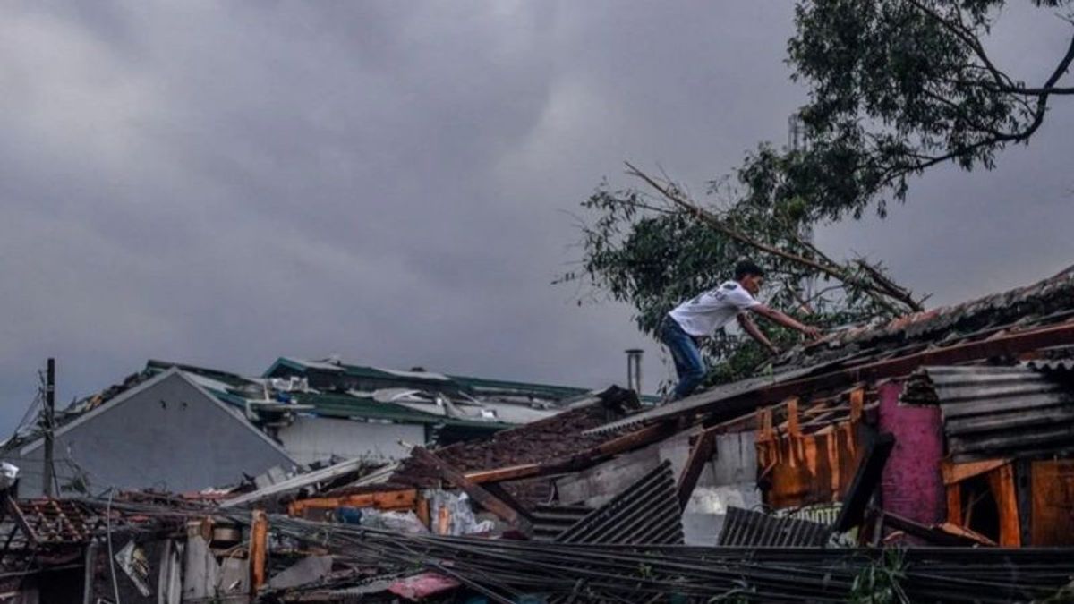
JAKARTA - The National Research and Innovation Agency (BRIN) stated that the extreme weather of tornadoes in Rancaekek, Bandung Regency, West Java, was a rare event and was located in the middle of the mainland.
"The phenomenon that occurs is an extreme weather event that shows the characteristics of a very strong tornado," said BRIN Center for Climate and Atmospheric Research Senior Research, Didi Satiadi, in a statement in Jakarta, Antara, Friday, February 23.
In English, the term tornado is known as a microscale tornado or a small-scale tornado because of its smaller size than a tornado that usually occurs in medium latitude areas.
Didi said the tornado phenomenon depicts a very fast rotating column of air, ranging from storm clouds to reaching the ground surface, and usually shaped like a funnel.
The results of the initial analysis show that the cause of the tornado is likely due to the convergence of the wind and water vapor in the mainland around the Rancaekek area in the afternoon.
This convergence causes the growth of cumulonimbus clouds to be very fast and widespread. The process of forming clouds frees up latent heat which further increases upraft or upstream airflow.
On the other hand, the stronger upraft will grow more clouds. This positive feedback cycle causes upraft to become stronger and can rotate due to windshear (differential direction/wind speed).
"The rotating air column is getting stronger and can reach the ground surface and produce tornadoes," said Didi.
BRIN Research Center for Climate and Atmospheric Research, Eddy Hermawan, revealed that Rancaek is an area located almost in the middle of the western part of Java Island.
The area was originally a green area marked by many trees. This means that the environment is still relatively clean.
However, now the area has turned its original green function into an industrial area. Such an area is usually prone to the vortex of the wind.
"“ In other words, there has been a change in the land cultivation, which was originally a teak forest, has now turned into a concrete forest," said Eddy.
He further explained that the industry produces a lot of emission gas that cannot freely return to the atmosphere due to greenhouse effects. With a solar broadcast longer than 12.1 hours, the area is very hot during the day and relatively cold at night.
The difference in temperature between night and day is very large. Without realizing it, the area suddenly turned into a low-pressure area. Such conditions began on February 19, 2024 and at that time, a collection of water vapor masses from various directions entered Rancaekek.
Eddy said the process took about 24-48 hours. Starting with the formation of baby cumulus clouds (known as Pre-MCS). Then slowly the sea grows to form a collection of cumulonimbus clouds that are ready to be rotated to form a large vortex or known as a tornado.
"Although the mechanism is rather complex to be explained in detail, it is strongly suspected that the vortex occurred due to a meeting of two water vapor masses from the west and east, then strengthened from the south of the Indonesian Ocean. The three of them gathered in an area that had indeed experienced quite sharp heat degradation,” said Eddy.
Almost all extreme events such as tornadoes in Rancaekek, for example, until now their presence is relatively difficult for scientists to predict. In addition to high-resolution data, it is still limited, but also the mechanism for its formation has not been understood properly and perfectly.
“ It's natural that sometimes we each have different views, ” concluded Eddy.
SEE ALSO:
The English, Chinese, Japanese, Arabic, and French versions are automatically generated by the AI. So there may still be inaccuracies in translating, please always see Indonesian as our main language. (system supported by DigitalSiber.id)
Most Popular Tags
#Prabowo Subianto #golkar #Pilkada Dki #online gambling #Mount Lewotobi malePopular
22 November 2024, 01:33
22 November 2024, 04:00
22 November 2024, 06:00


