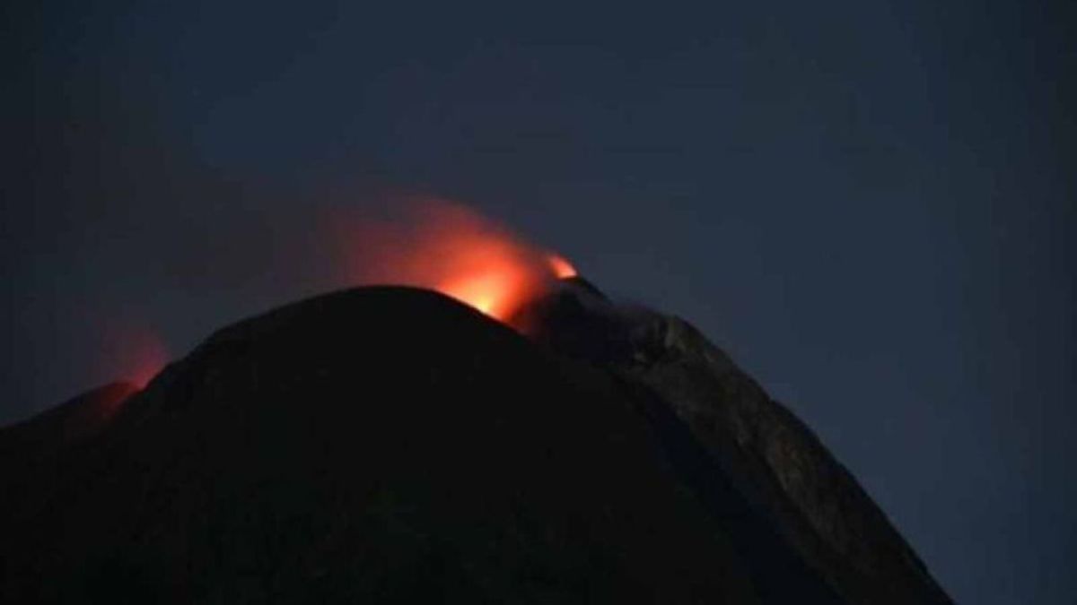


NTT - Explosive eruptions or eruptions continue to occur on Mount Ile Lewotolok, Lembata Regency, East Nusa Tenggara (NTT). The incandescent lava reaches up to a distance of 500 meters out of the crater.
"Based on the results of the evaluation starting June 23-30, 2024, it shows that there is still high activity of eruptions, and explosive eruptions are still ongoing," said Ile Lewotolok Volcano Monitoring Post Officer when contacted, Wednesday, July 3, as reported by Antara.
However, he said, both the eruption and the gusts of smoke had shown a decline compared to the period a week earlier.
He explained that the height of the eruption column can be higher than the one observed due to weather factors that cause visual observations not to be maximally carried out.
Meanwhile, the new lava flow in the southern region leading to Todanara Village and the southeast region leading to Jontona Village has not experienced a change in distance to date.
The lava flow to the southeast is still at a distance of 1.8 kilometers and 600 meters to the south. Meanwhile, the distance from the lava flow to the west, namely to Amakaka Village until May 27, is still in the range of 1.3 kilometers from the crater's lip and has not shown an additional flow distance.
"This indicates that the flow rate of lava both to the southeast, south and west has begun to shrink or slow down or could have stopped," he said.
SEE ALSO:
-
 | BERITA
Bapemperda DPRD Jakarta Buat Pasal Pidana untuk Pembuang Limbah Sembarangan
03 Juli 2024, 13:22 -
 | BERITA
KPK Tetapkan 2 Tersangka Baru Dugaan Korupsi Pengadaan LNG di PT Pertamina
02 Juli 2024, 17:42


In general, the number of earthquakes showing a decline with gusts still dominating on the record. Meanwhile, the tremors are still recorded with the average amplitude getting smaller.
Not only is it a shallow and deep volcanic earthquake still recorded, but it is not significant. However, the emergence of volcanic earthquakes indicates pressure or stress on the body of Mount Ile Lewotolok related to the supply of shallow and deep magmatic fluid.
Meanwhile, he said, the deformation data was still fluctuating, but showed that there was deflation or deflation due to changes in pressure on the body of Mount Lewotolok in the last week.
Based on the results of the analysis and evaluation, the Center for Volcanology and Geological Hazard Mitigation stated that the mountain activity was still at level II or Alert.
Therefore, people, visitors, and climbers are still recommended not to enter and not to carry out activities in the southern, southeast, and western sectoral areas, each 2.5 km from the activity center of Mount Ile Lewotolok.
The English, Chinese, Japanese, Arabic, and French versions are automatically generated by the AI. So there may still be inaccuracies in translating, please always see Indonesian as our main language. (system supported by DigitalSiber.id)
Popular


