

JAKARTA - Floods and landslides hit the city of Semarang due to extreme weather marked by high-intensity rain accompanied by lightning and strong winds since Wednesday, March 13.
The Head of the Semarang City Regional Disaster Management Agency (BPBD), Endro Pudyo Martanto, said that it rained in Semarang City from noon to night.
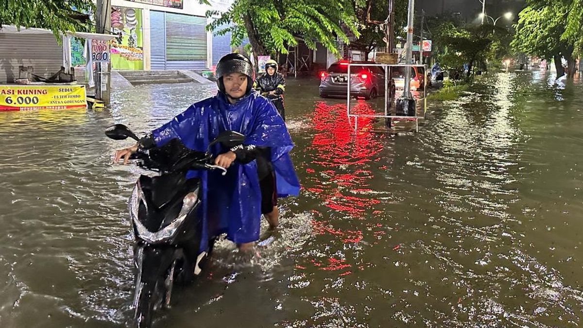
Endro said that reporting a number of points in the Semarang City area were flooded with a water level (TMA) of between 15-80 centimeters.
"The flood condition has also experienced a trend of increasing inundation due to the ongoing rain until midnight," said Endro in his statement, Thursday, March 14.
Floods also submerged the northern coastal lane on Jalan Raya Kaligawe so that the wheels of the pickup truck were not visible. The traffic along the route connecting Semarang City to Demak-Surabaya was also completely paralyzed.
Several trucks to mini buses were trapped in the floodwaters. In addition, the Semarang Old Town area was also submerged until an adult.
"Kaligawe Street is paralyzed," said Endro.
As a form of effort to accelerate emergency handling, the Semarang City Government has established an emergency post at the Semarang City Hall located on Jalan Pemuda Semarang City.
At the post, a team from the Semarang City BPBD together with cross-forkopimda also established a public kitchen to supply food for both affected residents and officers on guard during disaster management.
"We are preparing for a public kitchen at City Hall. The emergency post is at City Hall," explained Endro.
A number of areas reported to be flooded include:1. Jalan Gebanganom with a water level of 70 - 80 cm2. Jalan Padi Raya with a water level of 50 - 60 cm3. Jalan Sendang is beautiful Muktiharjo Lor Village with a water level of 15 cm4. Jalan Muktiharjo is beautiful RW 15 Muktiharjo Kidul Village with a water level of 15 - 20 cm5. Muktiharjo highway Muktiharjo Lor Village with a water level of 30 - 70 cm6. Jalan Jodipati Krobokan Village with a water level of 15 - 40 cm7. RW 7 area Kudu Village with a water level of 15 - 20 cm8. Tambakrejo Village area with a water level of 15 - 30 cm9. Jalan Raya Kaligawe (RSI Sultan Agung - Lower Tol) with a water level of 20 - 50 cm10. Jalan Sidorejo 3 Sambirejo Village with a water level of 20 - 30 cm
Meanwhile, landslides also resulted in damage to buildings belonging to residents. As for the impact of landslides, namely:1. Landslides on Jalan Srikaton west RT 2 RW 6 Purwoyoso Village2. Talud landslides RT 1 RW 7 Sendangmulyo Village3. Talud landslides Ngaglik Lama RT 3 RW 5 Bendungan Village4. Landslides on Jalan Jomblang Perbalan RT 1 RW 2 Candi Village5. Landslides on Jalan Gombel Lama RT 5 RW 5 Tinjomoyo Village6. Landslides Lempongsari RT 6 RW 1 Lempongsari Village7. Landslides at home in Kampung Baru RT 1 RW 15 Jomblang Village, Candisari District8. Talud landslides on Jalan Ngesti Waluyo Kelurahan Mlatibaru9. Talud landslides on Jalan Saputan Barat, RT 3 RW 13 Jomblang Village10. Landslides RT 04 RW 09 Kembangarum Village
SEE ALSO:


Then for the impact of strong winds include:1. Fallen trees hit the house of RT 1 RW 9 Sembungharjo Village2. Fallen trees in RT 1 RW 2 Candi Village 3. Fallen trees in front of the Progo Pump House, Mlatibaru Village4. Fallen trees hit the house of a Karanggeneng resident RT 3 RW 2, Sumurrejo Village 5. Fallen trees hit the roof of the Assajad mosque RT 03 RW 01 Sendangguwo6 Village. Fallen trees in RT 2 RW 9 Candi Village7. The roof collapsed on Jl Supriyadi Kalicari 2 RT 03 rw 04 Kalicari Village8. The roof was in front of the house of RT 06 RW 04 Kalicari 9 Village. The roof of the resident's house collapsed Wonodri Kopen III RT 05 RW 04 kel. WonoDRI10. The roof of the resident's house collapsed in RW 1 Candi 11 Village. The roof of the resident's house collapsed RT 5 RW 3 Randusari Village
The English, Chinese, Japanese, Arabic, and French versions are automatically generated by the AI. So there may still be inaccuracies in translating, please always see Indonesian as our main language. (system supported by DigitalSiber.id)


