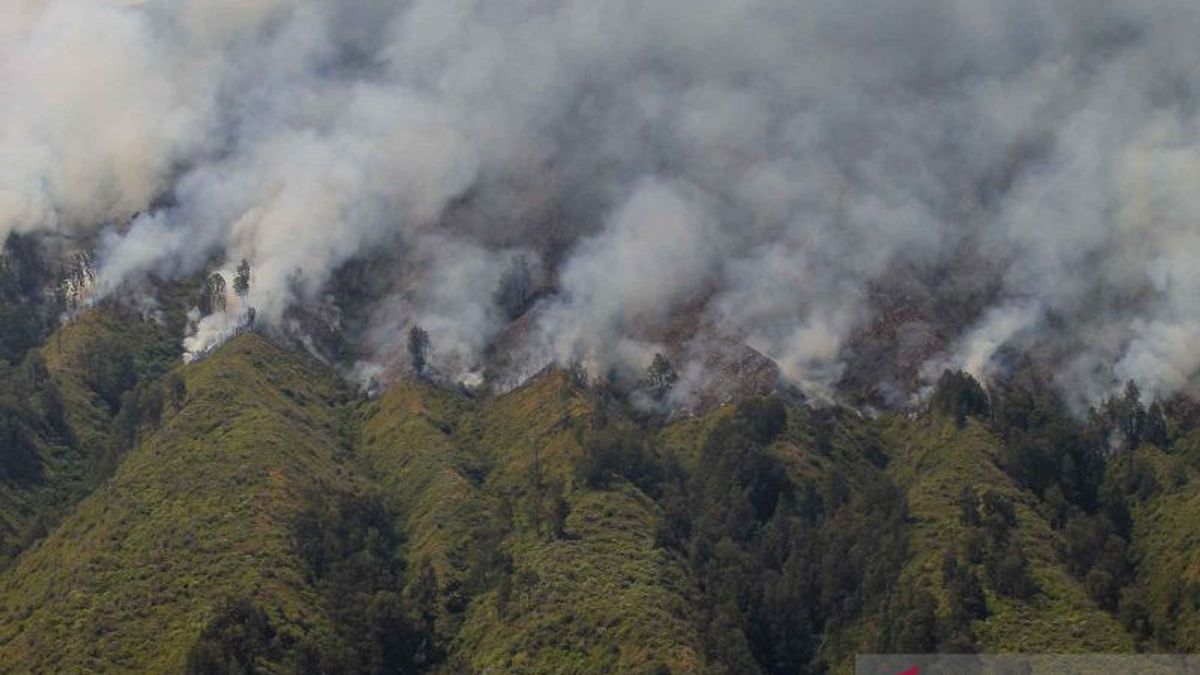


JAKARTA - The Ministry of Environment and Forestry (KLHK) has revealed the cause of the difficulty in extinguishing forest and land fires (karhutla) on Mount Bromo which were triggered by flares during a pre-wedding photo session. The fire has been going on for five days and is spreading.
"Access to the fire location is difficult, hilly and steep," said Director of Forest and Land Fire Control, Ministry of Environment and Forestry, Thomas Nifinluri, when contacted in Jakarta, as reported by Antara, Monday, September 11.
Thomas said that the rough terrain limited the firefighting team's movements, and the strong winds also triggered the fire to continue to burn through forests and land on Mount Bromo, East Java.
Even the Bromo Tengger Semeru National Park Center (TNBTS) was forced to close all access to the Mount Bromo tourist area to facilitate blackout operations.
The closure of the Bromo tourist area is stated in the Announcement Letter Number: PG.09/T.8/BIDTEK/9/2023 concerning the Closure of the Bromo Tengger Semeru National Park Hall Area.
"The closure will take effect from Sunday, September 10, 2023, starting at 19.00 p.m. Western Indonesian Time (WIB), until an undetermined time limit," said Thomas.
Based on information from the local Regional Disaster Management Agency (BPBD), the area of forest and land burned on Mount Bromo reached 274 hectares.
Thomas said the government would carry out extensive calculations by estimating the fire area using satellite imagery.
Activities to handle forest and land fires on Mount Bromo were carried out together with the East Java Province Task Force Team, the Malang Task Force Team, volunteers, people who care about fire, and the TNBTS National Forest and Fire Brigade Team.
"Aerial firefighting teams were also deployed for the second day with water bombing operations with the support of the National Disaster Management Agency (BNPB)," explained Thomas.
The TNBTS Center closed access to four entrances to the national park area due to forest and land fires that occurred in the area.
Access closures are enforced at all entrances starting at Coban Trisula in Malang Regency, Wonokitri in Pasuruan Regency, Cemorolawang in Probolinggo Regency, and Senduro in Lumajang Regency.
SEE ALSO:
-
 | BERITA
Viral Mobil Pelat Merahnya Keluarkan Asap Ngebul, Pemprov DKI Beri Sanksi Sopir
11 September 2023, 14:26 -
 | BERITA
Viral Knalpot Ngebul Mobil Pelat Merah di Mampang, Pemprov DKI: Itu Perjalanan ke Bengkel
11 September 2023, 13:44 -
 | BERITA
Penghapusan Kewajiban Penyusunan Skripsi Bisa Bikin Mahasiswa Malah Makin Tertantang
05 September 2023, 17:50


Head of the Administrative Section of the TNBTS Center Septi Eka Wardhani asked people who want to cross the Malang to Lumajang route and vice versa via Poncokusumo and Senduro to look for alternative routes due to the closure of the entrance access.
The English, Chinese, Japanese, Arabic, and French versions are automatically generated by the AI. So there may still be inaccuracies in translating, please always see Indonesian as our main language. (system supported by DigitalSiber.id)
Most Popular Tags
#Prabowo Subianto #donald trump #2026 World Cup #bgn #konflik timur tengahPopular


