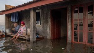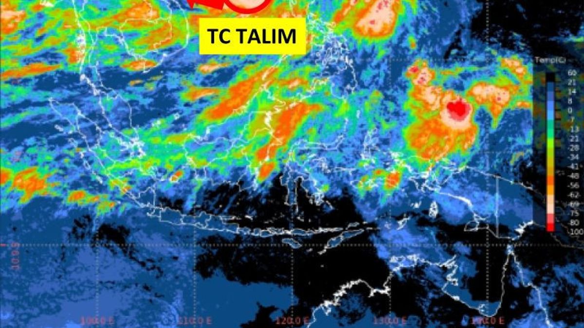


JAKARTA - The Meteorology, Climatology and Geophysics Agency (BMKG) said that the Talim Tropical Cyclone observed in the South China Sea could affect sea wave heights in Indonesian territory in the next few days.
BMKG Deputy for Meteorology Guswanto said Tropical Cyclone Talim was observed at coordinates 18.8 North Latitude and 116.1 East Longitude, about 1,730 km north of Tarakan, North Kalimantan.
The observed tropical cyclone moving west-northwest has a maximum wind speed of 50 knots and a minimum air pressure of 980 millibar (mb).
"It is estimated that the intensity of Tropical Cyclone Talim will increase in the next 24 hours and move to the west-northwest away from Indonesian territory," he said in Jakarta, Antara, Sunday, July 16.
The presence of the tropical cyclone can cause sea waves as high as 1.25 to 2.5 meters in Natuna-Anambas waters, Natuna Sea, Subi-Serasan waters, North Makassar Strait, Sulawesi Sea, and the waters of the Sangihe Islands-Talaud Islands.
The tropical cyclone can also cause waves as high as 1.25 to 2.5 meters in the waters of the Sitaro Islands, Bitung-Likupang waters, Maluku Sea, southern waters of North Sulawesi, northern Sorong waters, northern Jayapura waters, Cendrawasih Bay, and the northern Pacific Ocean of Biak.
Meanwhile, higher sea waves, approximately 2.5 to four meters, are likely to occur in the North Natuna Sea, the Pacific Ocean north of Halmahera, and the Pacific Ocean north of West Papua.
Guswanto appealed to residents living in coastal areas to be aware of the impact of high waves.
SEE ALSO:
-
 | BERITA
Petugas Rutan yang Diduga Lakukan Asusila Dipindah Jadi Penjaga Gedung KPK
27 Juni 2023, 06:04 -
 | BERITA
Pelaku Asusila di Rutan KPK Hanya Disanksi Etik Sedang, Begini Kata Dewas
26 Juni 2023, 14:43 -
 | BERITA
Kesal Minta Dicerai, Suami Tanpa Pekerjaan Tega Siram Istri Pakai Air Keras
20 Juni 2022, 15:15


The English, Chinese, Japanese, Arabic, and French versions are automatically generated by the AI. So there may still be inaccuracies in translating, please always see Indonesian as our main language. (system supported by DigitalSiber.id)
Most Popular Tags
#Prabowo Subianto #New Year #airplane accident #Hasto Kristiyanto #nataru #squid game 2Popular

05 Januari 2025, 10:15

05 Januari 2025, 08:02