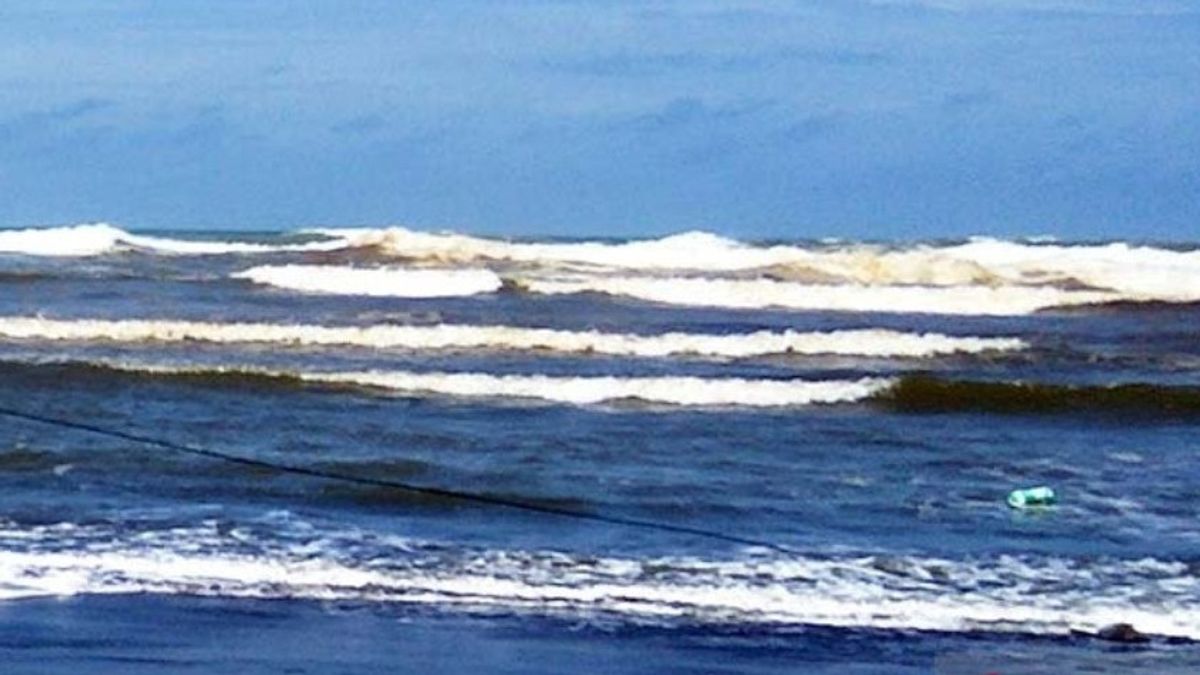


JAKARTA - The sea wave height in the south of West Java, Central Java, and the Special Region of Yogyakarta has the potential to reach 6 meters or very high. This is due to the wind pattern with a speed of 5-25 knots.
"The increase in wave height is influenced by wind patterns in the Indonesian region, which generally move from the southeast-southwest at 5-25 knots," said Teguh Wardoyo, Head of the BMKG Technician Group at the Tunggul Wulung Cilacap Meteorological Station, as reported by Antara, Friday, October 30.
According to him, this condition is predicted to continue in the next two days. So that his party issued an early warning of high waves in the southern sea of West Java-DIY which is valid until October 31 and will be updated if there are further developments.
He said that in the early warning of high waves, it was stated that the wave height in the southern waters of West Java-DIY and the southern Indian Ocean of West Java-DIY had the potential to reach 4-6 meters or was categorized as very high.
"Therefore, for tourists visiting the south coast of West Java to DIY, we urge you not to bathe or play in the water, especially on beaches that are directly connected to the high seas because waves of 4-6 meters can occur at any time and are very dangerous," he said. .
Furthermore, Teguh said based on a risk and safety analysis, wave heights of more than 1.25 meters and wind speeds above 15 knots are dangerous for fishing boats.
In addition, wave heights of more than 1.5 meters and wind speeds above 16 knots are dangerous for the barge and wave heights of more than 2.5 meters and wind speeds above 21 knots are dangerous for ferries.
Previously, the Head of the BMKG Maritime Meteorology Center Eko Prasetyo said fishermen must be able to anticipate the possibility of high waves, especially in the south-west seas of Sumatra to southern Nusa Tenggara.
"The southern regions of Java, south Sumatra, west Sumatra, to the south of Bali and Nusa Tenggara have relatively high waves. Fishermen almost find it difficult to find waves below two meters, it is very difficult, which often is 2-4 meters, 3-5 meters, even today, tomorrow, and the day after tomorrow six meters, "he said.
In fact, if the high waves are accompanied by important events, such as low pressure in an area, it will further disturb the weather in southern Java. "This must be anticipated by fishermen. Fishermen should not think for themselves, they cannot negotiate with their families themselves, but take advantage of information from the BMKG," he said.
Regarding the moderate La Nina phenomenon that is currently taking place, Eko said La Nina is a global phenomenon concerning climate, thus triggering increased rainfall in several regions.
"If we hear until now, the information we receive (La Nina, ed.) Can increase rainfall by 20-40 percent from normal, but it is not the same in every region. That will also be related to how the wind speed at sea, "he said.
According to him, the wind is the main generator of sea waves so that when the wind is strong, the waves automatically get higher.
Nevertheless, he appealed to the public not to worry or panic about the impact of La Nina on ocean waves, but rather need to adapt to their environment.
After the incident or phenomenon ends, he said, the community also needs to take mitigation so that when it occurs again it does not cause major losses.
The English, Chinese, Japanese, Arabic, and French versions are automatically generated by the AI. So there may still be inaccuracies in translating, please always see Indonesian as our main language. (system supported by DigitalSiber.id)


