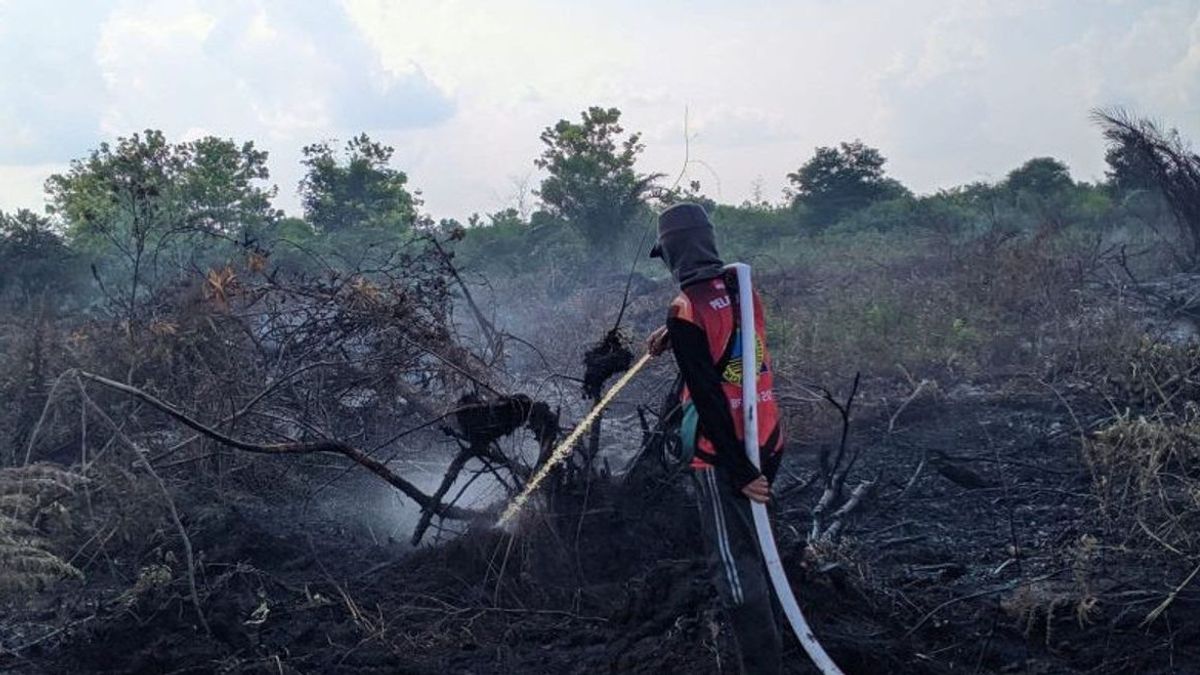


BANJARBARU - The Regional Disaster Management Agency (BPBD) of South Kalimantan Province (Kalsel) reported that the area of forest and land fires (Karhutla) was almost a thousand hectares.
Based on data from the South Kalimantan Disaster Management Operations Control Center (Pusdalops PB) as of Tuesday, August 1, there were around 3,214 hotspots with a forest and land fires area of around 995 hectares spread over 13 districts and cities.
"The highest number of hotspots is in Balangan Regency at around 702 points," said South Kalimantan BPBD Chief Executive Raden Suria Fadliansyah as quoted by ANTARA, Tuesday, August 1.
Suria said that although the district has the most hotspots, the area of forest and land fires does not dominate, which is only around 15 hectares throughout the 2023 incident.
He revealed that the most forest and land fires were in Banjarbaru City with an area of 445 hectares and as many as 102 hotspots.
The city of Banjarmasin is the area where at least six hotspots were found, while the lowest forest and land fires were in Tanah Bumbu Regency.
VOIR éGALEMENT:
-
 | BERITA
Jokowi: Tingkat Kepercayaan kepada Tuhan Tertinggi Jadi Modal Kuat RI
01 Agustus 2023, 21:55 -
 | BERITA
Kemlu Tanggapi Keluhan Pensiunan tentang Gaji Dalam Negeri yang Beulm Diberikan
01 Agustus 2023, 21:13
Until the first week of August 2023, all regencies and cities in South Kalimantan had been hit by forest and land fires with a record forest area of about 87 hectares burned and an area of approximately 907 hectares burned.
Based on ANTARA's monitoring until Tuesday night, forest and land fires hit two areas, namely the land area of Syamsudin Noor Airport, which was around five hectares but had been handled by officers, while in the Great Forest Park (Tahura) area of Sultan Adam, Banjar Regency, there was a fire at around 21.30 WITA.
The English, Chinese, Japanese, Arabic, and French versions are automatically generated by the AI. So there may still be inaccuracies in translating, please always see Indonesian as our main language. (system supported by DigitalSiber.id)
Tags les plus populaires
#Prabowo Subianto #Golkar #OTT KPK #élections jakarta #jeux d’argent en lignePopulaire