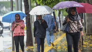


CENTRAL CITY - The Meteorology, Climatology and Geophysics Agency (BMKG) has asked travelers crossing the southern route of Central Java to be alert to extreme weather.
The Head of the BMKG Technician Group at the Tunggul Wulung Meteorological Station in Cilacap, Teguh Wardoyo, said that rain with heavy to moderate intensity still has the potential to fall in South Central Java.
"Until now, the potential for rain in southern Central Java is still there. The characteristic of the rain is transitional rain", said Teguh in Cilacap, Tuesday, April 26.
He said the characteristics of rain during the transition period were marked by weather conditions in the morning which tended to be hot, but in the afternoon there began to be a lot of clouds, especially Cumulonimbus (Cb) clouds.
Rain tends to occur in the afternoon to evening with moderate to very heavy intensity, but of shorter duration, sometimes accompanied by lightning and strong winds. "Such weather conditions can trigger a tornado", he said.
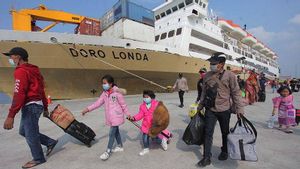
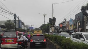
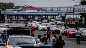
Therefore, he said, travelers, especially those riding motorbikes, are advised to be careful and be aware of the potential for rain accompanied by strong winds in the southern route of Central Java, especially the Panulisan section (the border between Central Java and West Java, ed.) to Wangon.
According to him, this is because the road conditions on the Panulisan to Wangon sections are winding and there are many points prone to landslides and subsidence.
"Even if it's a little bit, the landslide that falls onto the highway when it rains will make the road slippery, making it dangerous to travel at high speed", he said.
He said information on special weather forecasts on the homecoming route could be accessed via the https://publik.bmkg.go.id/cuaca-mudik page.
VOIR éGALEMENT:

Asked about the existence of two low pressure or tropical cyclones that had affected weather conditions in parts of Indonesia, Teguh said that currently only 98S still exists in the Indian Ocean southwest of Java, while 99S which previously appeared in the Banda Sea has disappeared.
In fact, he said, the current low-pressure condition of 98S has weakened and its impact on rainfall has reduced.
"Thus, the local intensive heating factor will play a greater role in triggering the formation of convective clouds that trigger rain", he said.
The English, Chinese, Japanese, Arabic, and French versions are automatically generated by the AI. So there may still be inaccuracies in translating, please always see Indonesian as our main language. (system supported by DigitalSiber.id)
Tags les plus populaires
#Prabowo Subianto #Nouvel An #accident d’avion #Hasto Kristiyanto #nataru #squid game 2Populaire