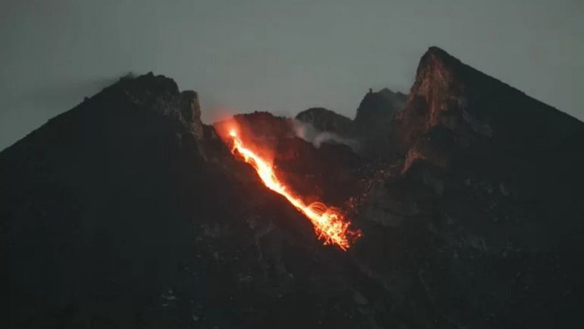


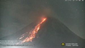
YOGYAKARTA - Mount Merapi on the border of the Special Region of Yogyakarta and Central Java launched 15 incandescent lava flows to the southeast and southwest on Sunday, July 25.
Head of the Center for Research and Development of Geological Disaster Technology (BPPTKG), Hanik Humaida, through his official statement in Yogyakarta, said the incandescent lava to the southwest slid 10 times with a maximum sliding distance of 1,500 meters from 00.00 to 06.00 WIB.
Meanwhile, the lava to the southeast slid five times with a maximum distance of 1,000 meters. "The crater smoke was observed to be white with a thin intensity and 100 meters high above the crater peak", said Hanik as reported by Antara.
")
In addition to incandescent lava, Merapi experienced 25 avalanches with an amplitude of 4-26 millimeters (mm) for 28-102 seconds, two earthquake gusts with an amplitude of 4 millimeters (mm) for 11.9-13.8 seconds.
Next, 54 multi-phase earthquakes with an amplitude of 3-22 millimeters (mm) for 5.6-7.7 seconds and 13 shallow volcanic earthquakes with an amplitude of 55-75 millimeters (mm) for 8.7-13.2 seconds, and one distant tectonic earthquake with an amplitude of 8. millimeters (mm) for 61 seconds.
Meanwhile, for the observation period on Saturday, July 24 night, at 18.00-24.00 WIB, Mount Merapi recorded eight incandescent lava avalanches with a maximum sliding distance of 1,200 meters to the southwest and six times to the southeast as far as 1,000 meters.
")
Until now BPPTKG still maintains the status of Mount Merapi at Level III or Alert. The lava fall and hot clouds of Mount Merapi are estimated to have an impact on the south-southwest sector including the Yellow River, Boyong, Bedog, Krasak, Bebeng, and Putih.
Meanwhile, if an eruption occurs, the ejection of volcanic material from Mount Merapi can reach a radius of three kilometers from the top of the mountain.
SEE ALSO:
-
 | BERITA
30 Persen WNI-WNA dari Luar Negeri Positif COVID-19 saat Dites PCR Kedua
16 Juli 2021, 17:26 -
 | BERITA
Update COVID-19 per 16 Juli: Kasus Baru 54 Ribu, Akumulasi 2.780.803 Kasus
16 Juli 2021, 16:33

The English, Chinese, Japanese, Arabic, and French versions are automatically generated by the AI. So there may still be inaccuracies in translating, please always see Indonesian as our main language. (system supported by DigitalSiber.id)


