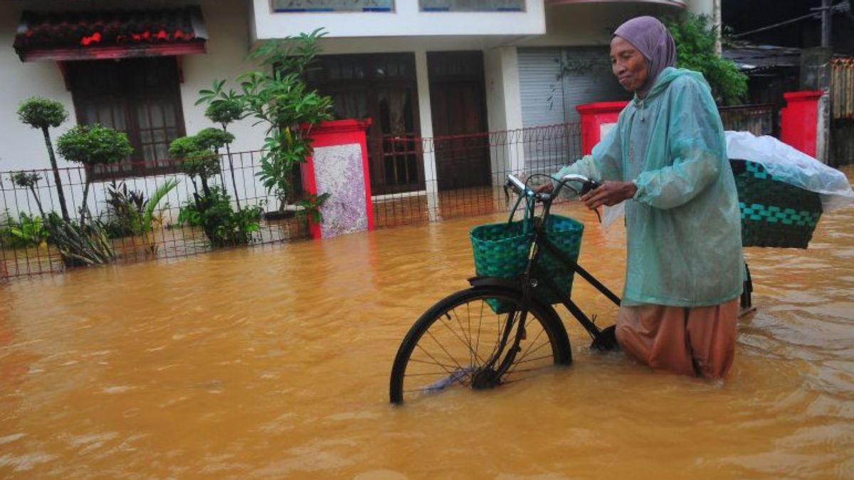


JAKARTA - The Meteorology, Climatology and Geophysics Agency (BMKG) has asked coastal areas to anticipate the potential for extreme rain or very heavy due to the weak La Nina phenomenon. This condition is able to increase the volume of coastal flooding (rob), including in Jakarta.
Head of the BMKG Maritime Meteorology Center Eko Prasetyo said the volume of tidal flooding in the coastal area would increase when heavy rains coincided with the maximum tide phase of sea water.
"The intensity of rainfall has a impact on coastal areas when it occurs at the same time as the maximum tide phase. The volume increases when there is a maximum tide," he said in Jakarta, Thursday, January 30, was confiscated by Antara.
Eko said that the increase in rainfall had nothing to do with sea water wave heights, so shipping activities for fishing boats or sea transportation tended to be conducive.
However, according to him, the potential for tidal flooding will have an impact on community activities on the coast in general, salt pond activities and land fisheries, and have an impact on activities such as loading and unloading at ports.
BMKG previously detected the presence of atmospheric phenomena such as Maden Julian Oscilliation (MJO) in the Indian Ocean leading to Indonesian territory which is generally currently in the peak period of the rainy season along with the weak La nina phenomenon.
The BMKG reported this condition has the potential to bring extreme rain or very heavy more than 50 mm per hour from mid-January 28 to the first basis in February, especially in the areas of Jakarta, West Java, and West Sumatra.
Meanwhile, at the same time, the BMKG maritime team also detected the phenomenon of the new Moon and Perigee (the closest distance to the moon to earth) on January 29 - February 2 which has the potential to increase the maximum sea level-launched tidal waves in a number of areas in Indonesia.
During this period, tidal flooding has the potential to target the North Sumatra Coastal Area (Medan Belawan, Medan Labuhan, Merelan), Riau Islands (Batam, Dabo Singkep, Karimun, Bintan), West Sumatra (Padang Pariaman, Padang, Painan).
Then Jambi (Hala Strait), Bangka Belitung Islands (Pangkal Pinang, Mentok), Lampung (Bandradelampung), Banten (Tangerang north, Serang north, Sunda Pandeglang Strait, south of Pandeglang, southern Lebak).
SEE ALSO:
-
 | BERITA
Prabowo Perintahkan Efisiensi Anggaran, Pemprov DKI Buka Opsi Kurangi Hibah untuk Ormas
28 Januari 2025, 10:42
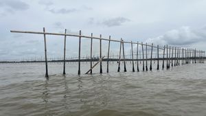


Furthermore, the coast of Jakarta (the majority of the northern coastal areas of Jakarta), Central Java (south of Sukabumi and Cianjur, Cilacap, Kebumen, Purworejo, Semarang, Demak, Pekalongan, Brebes, Tegal, Pemalang), DI Yogyakarta (Yogyakarta), East Java (port Surabaya, east Surabaya).
West Nusa Tenggara (Lombok and coastal Bima), East Kalimantan (East and west Balikpapan), South Kalimantan (Barito, Kotabumbu, Tanah Baru, Tanah Laut), Central Kalimantan (Kotawaringin, West Kotawaringin), West Kalimantan (pesisir West Kalimantan), Maluku (Central Maluku, Saumlaki, Kai Islands, Aru, eastern Seram, Ambon), North Maluku (Loloda, Morotai, Tobelo, Ternate, Taliabu).
The BMKG advises the public, especially those who are active in coastal areas on the roofs of hilly slopes, to continue to follow the daily weather developments reported by the BMKG weather forecaster team every three hours, and comply with disaster impact management instructions by officers from relevant government agencies in their respective regions.
The English, Chinese, Japanese, Arabic, and French versions are automatically generated by the AI. So there may still be inaccuracies in translating, please always see Indonesian as our main language. (system supported by DigitalSiber.id)
Most Popular Tags
#Prabowo Subianto #donald trump #2026 World Cup #venezuela #konflik timur tengahPopular


