JAKARTA - The danger zone radius for the eruption of Mount Lewotobi Laki in East Flores, East Nusa Tenggara is expanded to 9 kilometers in the southwest-northwest sector and 7 kilometers from the crater peak by the Geological Agency of the Ministry of Energy and Mineral Resources.
Head of the Geological Agency of the Ministry of Energy and Mineral Resources Muhammad Wafid said this decision was taken after a significant increase in volcanic activity in the period 7-9 November 2024.
The danger zone radius means that no one can move within the zone with the specified radius except for joint officers because of the high risk of being directly affected by the eruption of MountLewotobi Laki.
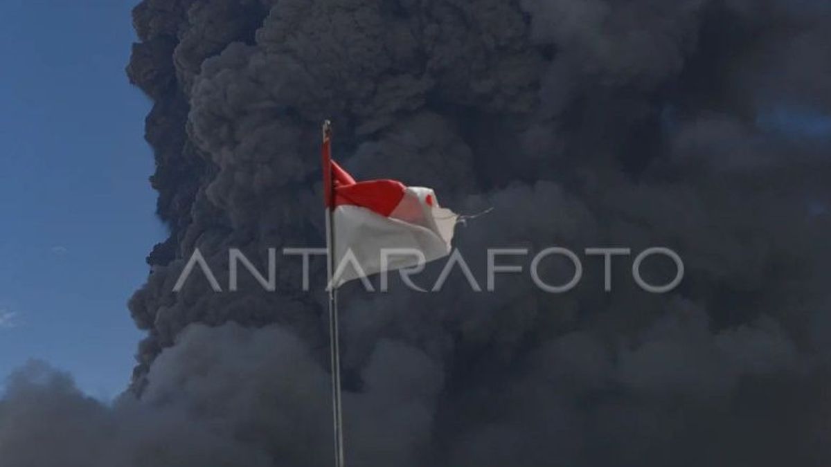
Visual observations made by the Geological Agency volcano observation post officer in East Flores found white to thick brown main crater smoke with a height of 8 kilometers from the summit.
Large eruptions occurred several times, including on November 7 and 9, with the height of the ash column reaching 9 kilometers from the summit or 10 kilometers from above the sea and hot clouds sliding as far as 2-3 kilometers to the northwest.
Data on the seismicity of Mount Lewotobi Male-Laki recorded 20 earthquakes of eruption, 19 gusts, and dozens of harmonic and volcanic tremors indicating an increase in magma activity.
Volcano monitoring post officers from the Geological Agency explained in detail that during the period 7-8 November 2024, 20 eruption/eruption earthquakes were recorded, 19 gusts, 23 harmonic tremors, three shallow volcanic earthquakes (VB), 11 deep volcanic earthquakes (VA), and continuous tremors with amplitudes ranging from 1.4-17.7 mm.
"Earthquakes were recorded which were associated with tectonic activity, namely four local tectonic earthquakes," he said.
He said the earthquake during November 9, 2024 to 06.00 WITA, was recorded as one eruption or eruption earthquake, one gust earthquake, one distant tectonic earthquake, and continuous tremors with an amplitude ranging from 1.4-7.4 mm
SEE ALSO:
Wafid said that although the volcanic activity of Mount Lewotobi Male was increasing and the hazard zone radius was expanded, the volcanologous analysis so far showed that this condition did not have the potential to cause a tsunami.
A total of 8,431 residents were displaced due to a series of eruptions based on data reported by the East Flores BPBD, Friday (8/11) night. The victims included residents of Titihaena, Wunggitang, Ile Bura, Demon Pangong, Larantuka, Sikka, Ile Mandiri, and East Adonara sub-districts.
The English, Chinese, Japanese, Arabic, and French versions are automatically generated by the AI. So there may still be inaccuracies in translating, please always see Indonesian as our main language. (system supported by DigitalSiber.id)


