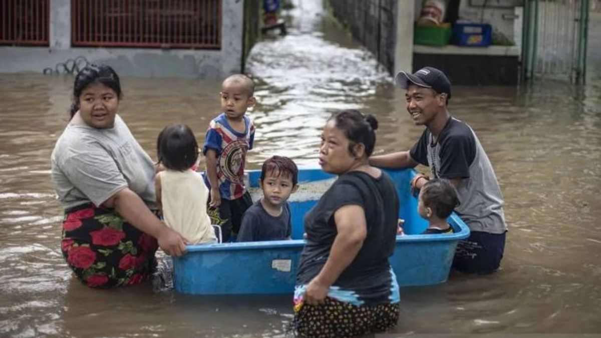
JAKARTA - The Meteorology, Climatology and Geophysics Agency (BMKG) warned as many as four provinces to be prepared to face potential flooding triggered by moderate-intensity rainfall for the period 11 - 20 June 2024.
Based on data from the Deputy for Climatology, the BMKG received in Jakarta, Friday, reported that the four provinces were prepared for potential flooding due to the high intensity of rainfall, including South Sumatra, Maluku, Central Papua and Southwest Papua.
Reported by ANTARA, Friday, June 14, a team of BMKG klimatologists classified the potential for flooding in South Sumatra in a low category. However, based on the results of the basic analysis of II which lasted until June 20, the rain will be evenly distributed covering all 17 districts/cities, so it remains to be warned to be alert.
BMKG predicts that this potential will hit from Banyuasin, Empat Lawang, Lahat, Muara Enim, Musi Banyuasin, Musi Rawas, North Musi Rawas, Ogan Ilir, Ogan Komering Ilir, Ogan Komering Ulu, Ogan Komering Ulu Selatan, Ogan Komering Ulu Timur, Penukal Abab Lematang Ilir, to Pagar Alam, Lubuk Linggau, and Palembang cities.
Furthermore, for the Provinces of Maluku, Central Papua and Southwest Papua, the same method is classified by BMKG in the category of areas with high flood potential.
The potential for high flooding in Maluku Province is predicted to include Ambon City (Baguala District, South Leitimur, Nusaniwe, Sirimau, Telukambon), Central Maluku Regency (Amahai District, Leihitu, West Leihitu, Pulauharuku, North Seram), West Seram Regency (Mamalatu District, Huamual, Inamosol, Kairatu, and West Kairatu).
Southwest Papua Province includes Maybrat Regency (Mare District), Sorong Regency (Kecamatan Makbon, Sayosa), and South Sorong (Kecamatan Sawiat).
SEE ALSO:
Then, the potential for high flooding in Central Papua Province includes Mimika Regency ( Amar District, Iwaka, Kuala Kencana, Kwamki, Narama, West Mimika and its surroundings), Deiyai Regency (W Bowobado District, Kapiraya, Tigi Barat), and Memberamo Raya (Memberamo Hulu and Rufaer Districts).
Previously, BMKG Deputy for Meteorology Guswanto explained that the potential impact of disasters due to rain in a number of parts of Indonesia that were still high could have occurred, although it had actually started entering the dry season.
According to him, the potential for increased rain is triggered by several atmospheric dynamics that are still active in Indonesian territory, namely the Madden Julian Oscillation (MJO) phenomenon, Rossby Kelvin equatorial waves, to cyclonic circulation patterns and potential for the formation of bend areas and wind slowdown.
The combination of the influence of these phenomena is predicted by the BMKG meteorological team to create the potential for moderate-heavy rain accompanied by lightning / strong winds.
BMKG assesses that such conditions can also have an impact on extreme hydro-meteorological weather which includes floods, flash floods, rain lava floods, landslides and so on, although at the same time Indonesia began to be hit by the dry dry dry dry dry season in mid-June September 2024.
The English, Chinese, Japanese, Arabic, and French versions are automatically generated by the AI. So there may still be inaccuracies in translating, please always see Indonesian as our main language. (system supported by DigitalSiber.id)


