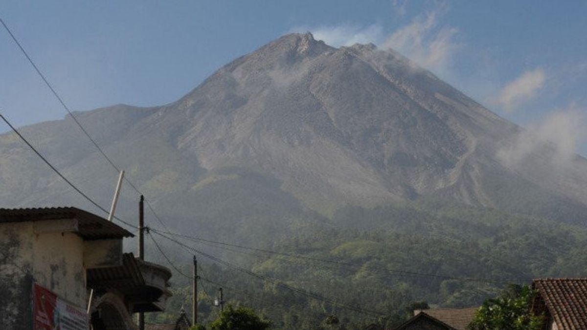


YOGYAKARTA - Mount Merapi on the border of the Special Region of Yogyakarta (DIY) and Central Java (Central Java) issued seven hot clouds of avalanches in a row to the southwest on Monday (4/3) afternoon.
Head of the Geological Disaster Technology Research and Development Center (BPPTKG) Agus Budi Santoso said that the series of hot clouds falling occurred from 16.03 WIB to 16.32 WIB.
"Two hot clouds of avalanche to the southwest (Kali Bebeng) were observed with a maximum sliding distance of 2,600 meters," Agus said as quoted by ANTARA, Monday, March 4.
During the observation period from 12.00 WIB to 18.00 WIB, BPPTKG also recorded seven avalanche hot cloud earthquakes with an amplitude of 42-48 mm, for 115,44-258.4 seconds, 46 avalanches with an amplitude of 3-42 mm, for 24.6-176.6 seconds.
Next four hybrid earthquakes or multi-phase earthquakes with an amplitude of 3-6 mm for 6,12-8.6 seconds and one shallow volcanic earthquake with an amplitude of 40 mm for 9.88 seconds.
SEE ALSO:
-
 | BERITA
Bawaslu Telusuri Laporan Perbedaan Suara PSI di Sirekap dengan Formulir Model C
04 Maret 2024, 17:53


Based on the morphological analysis of Merapi for the period 23-29 February 2024, he said the morphology of the southwest dome of Mount Merapi was observed to change slightly due to lava avalanche activity, while the morphology of the middle dome was relatively fixed.
Meanwhile, the analysis of air photos on January 10, 2024 showed the volume of the southwest dome of Mount Merapi was measured at 2,663,300 cubic meters and the middle dome was 2,358,400 cubic meters.
Until now, BPPTKG still maintains the status of Mount Merapi on the border of Central Java and DIY at Level III or Alert.
To anticipate the potential danger of the eruption of Mount Merapi, BPPTKG appealed to the public not to carry out any activities in areas of potential danger.
The lava fall and hot clouds from Mount Merapi can have an impact on areas in the south-southwest sector which include the Boyong River (a maximum of five kilometers) and the Bedog, Krasak, and Bebeng rivers (a maximum of seven kilometers).
The English, Chinese, Japanese, Arabic, and French versions are automatically generated by the AI. So there may still be inaccuracies in translating, please always see Indonesian as our main language. (system supported by DigitalSiber.id)
Most Popular Tags
#Prabowo Subianto #donald trump #2026 World Cup #venezuela #konflik timur tengahPopular


