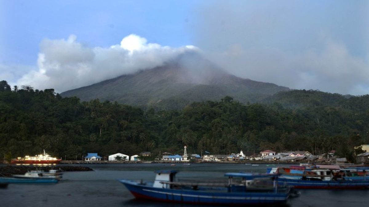


JAKARTA - The Ministry of Energy and Mineral Resources (ESDM) modernized 12 volcanic monitoring systems in 2023 as an effort to produce more accurate monitoring data.
Minister of Energy and Mineral Resources Arifin Tasrif said modernizing the volcano monitoring tool would complement the competent and resilient personnel owned by the Geological Agency of the Ministry of Energy and Mineral Resources.
"We are working to optimize all existing scanning systems for modernization. We will upgrade the capabilities of the personnel there and improve coordination with the local government so that they can anticipate and cooperate if urgent matters need to be implemented immediately," he said in a written statement, Tuesday, January 16, quoted by Antara.
Arifin also said that the existence of a technological disaster in the form of a volcano, earthquake, and landslide movement requires mitigation, so that casualties and losses can be minimized, among others, by using modern and functioning tools.
"We must carry out more massive programs to be able to monitor and anticipate it, among others, by modernizing the equipment we have to be more accurate," he said.
Meanwhile, the Geological Agency noted that apart from modernizing 12 volcanic monitoring systems, a total of 1,063 units, it also developed six volcanic observation posts, bringing the total to 19 units.
SEE ALSO:
-
 | BERITA
Istana Tepis Isu Jokowi Angkat Jutaan PNS Jika Prabowo-Gibran Menang
16 Januari 2024, 14:25 -
 | BERITA
KPU Ungkap 1 TPS di Rejang Lebong Blank Spot Internet, Akses Sirekap Terkendala
15 Januari 2024, 23:56

The Geological Agency also noted that in 2023, there were 251 tectonic earthquakes with a magnitude of > Mw5, 30 destructive earthquakes, and no tsunamis. Seven people died and 24 people were injured.
Then, there were 810 incidents of ground movement with 140 people dead, 65 injured, and 920 damaged houses.
There are also six volcanic eruptions, namely Semeru, Marapi, Anak Krakatau, Dempo, Dukono, Ibu, Ili Lewotolok, and Lewotobi Men.
Throughout 2023, the Geological Agency also recorded an additional four mappings of Volcano Geology (a total of 116 maps), an additional two mappings of Volcano Disaster Prone Areas (a total of 111 maps), an additional four mappings of Earthquake-Prone Areas (a total of 51 maps), an additional five mappings of Tsunami-Prone Areas (a total of 58 maps), and an additional six mappings of the Land Movement Vulnerability Zone (a total of 12 maps).
The English, Chinese, Japanese, Arabic, and French versions are automatically generated by the AI. So there may still be inaccuracies in translating, please always see Indonesian as our main language. (system supported by DigitalSiber.id)


