

MAKASSAR - The Meteorology, Climatology and Geophysics Agency (BMKG) Region IV Makassar said that the floods that hit parts of Makassar City, South Sulawesi, were triggered by sea waves rising up to 4 meters.
"This morning the tidal period was with a height of 1.2 meters. At the same time there was extreme rainfall," said Head of the BMKG Data and Information Division Region IV Makassar Hanafi Hamzah as quoted by ANTARA, Monday, February 13.
He explained, when extreme rainfall occurs with heavy to very heavy intensity which reaches 50 millimeters to 150 millimeters, it causes a buildup of water, on the other hand, tides rise to the surface
"Flooding is due to high tides in rivers from sea to land, and at the same time rainwater flows from land to river. As a result of meeting the two water flows, the water flow stagnates. Finally, the water does not move into the sea," said Hanafi.
However, the incident lasted for two hours, and the river flow that houses rainwater flows from the surface will return to the sea. This, he said, is a picture of observations that have occurred since this morning.
Based on satellite imagery observations on the BMKG graphic diagram of the Makassar Maritime Meteorology Station, he said, the tide was in the west position of South Sulawesi covering the western region of Makassar to Parepare.
"Grafi on the X axis is an hourly period, the Y axis is the height of the sea tide. Between 09.00-10.00 WITA the height peak is 1.2 meters. At 21.00 WITA, the peak is expected to be tidal waves with an altitude of 1.2 meters," said Hanafi.
Previously, BMKG Region IV Makassar issued early warning information on February 12-16, 2023, with heavy-very heavy rainfall potentially occurring in the South Sulawesi region.
Meanwhile, the height of waves with a moderate category of 1.25 and 2.5 meters occurred in the waters of Parepare, the waters of Semrmonde Pangkep, the western waters of the Selayar Islands, the waters of Sabalana, the northern Bone Bay, the southern part of Bone Bay.
The eastern waters of the Selayar Islands, northern Flores Sea, western Flores Sea, northern Bonerate Island-Kalaotoa Waters, and southern Bonerate Island-Kalaotoa waters.
Then the wave heights with a height category of 2.5-4.0 meters in the southern part of the Makassar Strait, the waters of western Semrmonde Pangkep, the western part of the Semrmonde Makassar, and the eastern part of the Flores Sea.
The same thing was conveyed by the Mayor of Makassar Moh Ramdhan Pomanto that since this morning there has been an increase in tides, so that rainwater does not flow to the estuary, including clogged drainage factors resulting in puddles. The tide occurs twice today.
"Earlier at 09.00 WITA, (the tide) and at 18.00 WITA (the tide) rose again, it was higher. However, we all ranks went to the field to ensure the condition of the community is safe," said the man who is familiarly called Danny Pomanto while reviewing the floods on Jalan Sulawesi.
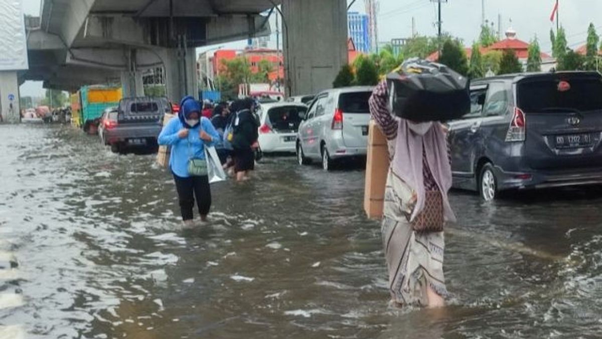
Based on monitoring, the impact of the worst flooding was on the edge of Losari Beach, two large hotels namely Arya Duta and MGH and the Karebosi shopping center were submerged in water. Even along Jalan Sulawesi, Jalan Nusantara, Makassar Port and its surroundings, which are adjacent to the coastal area, the water level reaches one meter.
Floods also submerged a number of protocol roads including Jalan Andi Pangeran Pettarani, Jalan Urip Sumoharjo, Jalan Perintis and its surroundings. Offices, hotels, and shops as well as residential areas including Hasanuddin Airport have not escaped water coverage. So far, the Makassar BPBD is still collecting data and evacuating affected residents.
The English, Chinese, Japanese, Arabic, and French versions are automatically generated by the AI. So there may still be inaccuracies in translating, please always see Indonesian as our main language. (system supported by DigitalSiber.id)


