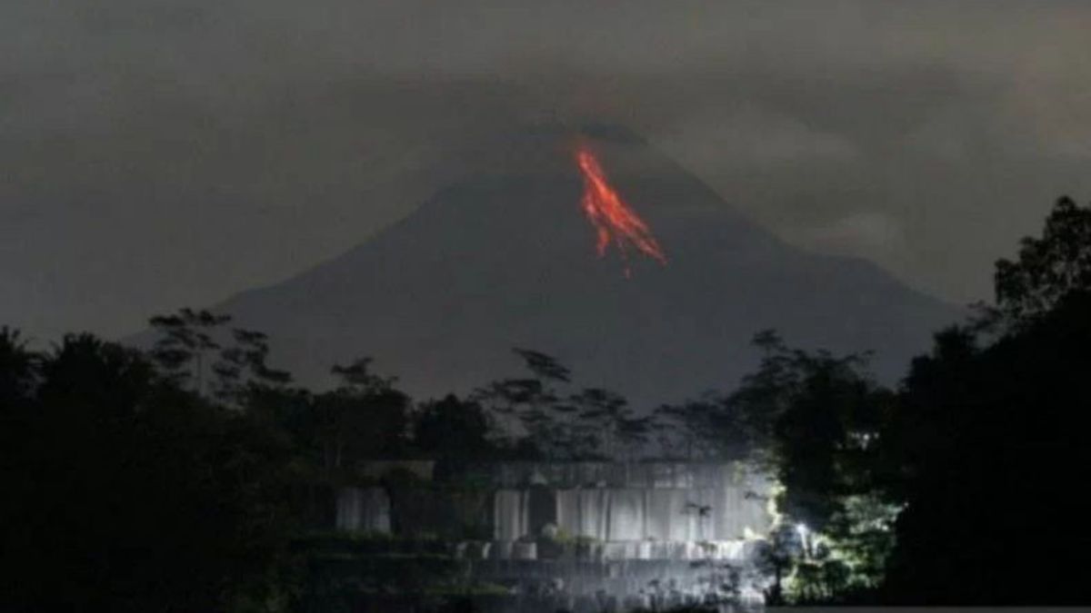


YOGYAKARTA - The Yogyakarta Geological Disaster Technology Research and Development Center (BPPTKG) noted that Mount Merapi during August 2022 experienced up to 100 internal earthquakes per day.
"With this increase in seismic activity, the public is advised to remain calm and carry out activities as usual but still maintain preparedness", said Head of BPPTKG, Agus Budi Santoso, in a written statement from the Yogyakarta office, Antara, Wednesday, September 14.
According to Agus, the internal earthquake of Mount Merapi was dominated by deep volcanic earthquakes (VTA), which is a marker of magmatic activity below the peak of Mount Merapi at a depth of about 1.5 km.
Agus explained, that this condition indicates that there is magma supply activity which if it comes out to the surface it will be in the form of an effusive extrusion as has happened since January 4, 2021.
"This is different from the 2010 eruption which was also preceded by VTA earthquakes, but with a different character, where the frequency and energy of VTA earthquakes at that time was higher", he said.
Agus said that Mount Merapi had experienced an effusive eruption for more than 1.5 years.
According to him, Merapi's volcanic activity is still high, as can be seen from the number of daily earthquakes and deformations that continue to occur.
On September 7, 2022, the volcano, which is located on the border of the Special Region of Yogyakarta and Central Java, experienced an earthquake tremor with a frequency of 6 Hz, which reflected gas fluid activity in the magma chamber.
Based on BPPTKG records, the earthquake tremor on the mountain when occurred only once with an amplitude of about 10 mm and a duration of 29 seconds.
"Until now the earthquake tremor does not indicate a significant change in the increase in volcanic activity of Mount Merapi", said Agus.
Agus said that BPPTKG had not changed the recommendations for hazard areas and that Mount Merapi was still on Alert or Level III.
"The hazard recommendations are still the same because the volume of the lava dome is still relatively the same, which is around 2.8 million cubic meters in the middle dome and 1.7 million cubic meters in the southwest dome", he said.
SEE ALSO:
-
 | BERITA
Lukas Enembe Jadi Tersangka Korupsi, KPK: PPATK Blokir Rekening yang Bernilai Fantastis
14 September 2022, 18:16 -
 | BERITA
Besok, MKD Panggil Effendi Simbolon Buntut Pernyataan 'TNI Seperti Gerombolan'
14 September 2022, 14:20


He said that currently, the avalanche of lava and hot clouds of Merapi could have an impact on the south-southwest sector which includes the Boyong River and Bedog, Krasak, and Bebeng Rivers as well as the southeast sector which includes the Woro River and Gendol River.
Meanwhile, the ejection of volcanic material in the event of an explosive eruption is estimated to reach a radius of three kilometers from the summit of Mount Merapi.
The English, Chinese, Japanese, Arabic, and French versions are automatically generated by the AI. So there may still be inaccuracies in translating, please always see Indonesian as our main language. (system supported by DigitalSiber.id)
Most Popular Tags
#Prabowo Subianto #donald trump #2026 World Cup #venezuela #konflik timur tengahPopular


