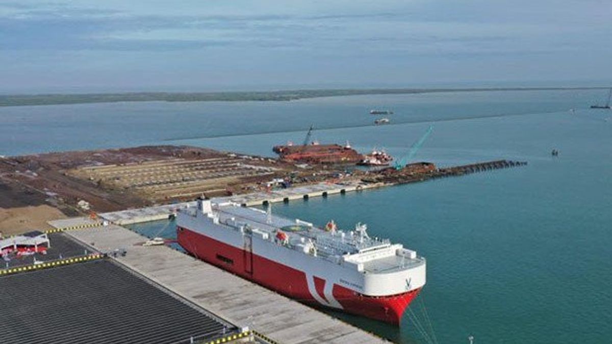
JAKARTA - The Ministry of Transportation has prepared infrastructure facilities to support operational activities at Patimban Port, Subang, West Java, which are carried out by the Tanjung Priok Class I Navigation District.
Director of Navigation at the Ministry of Transportation, Hengki Angkasawan said there were several things related to navigation that had been prepared, including those related to the arrangement of shipping lanes, Shipping Navigation Assistance Facilities (SBNP), delivery of Maritime Safety Information (MSI) news, and also the preparation of Indonesian marine maps, both Electronic Nautical Charts (ENC) as well as paper sea maps, in collaboration with the Indonesian Navy's Hydrographic and Oceanographic Center (PUSHIDROSAL).
"All of these are very important aspects in supporting the operational activities of the Patimban Port, to improve shipping safety and protect the maritime environment", said Hengki Angkasawan in a press statement, quoted from Antara, Monday, June 7.
He explained that the Patimban port shipping lane had been determined through the Decree of the Minister of Transportation Number KM 272 of 2020 concerning the Determination of Shipping Lines, Route Systems, Traffic Procedures, and Ship Harboring Areas by their Interests in the Patimban Port Entry Channels.
"The length of the shipping channel in Patimban is 25 NM, with a channel width of 160 to 500 meters, and a depth of 10 meters Low Water Spring", he said.
Hengki explained that the Patimban shipping lane has also been equipped with 15 units of Sailing Navigation Auxiliary Facilities (SBNP) consisting of 11 flare buoys and 4 temporary flare buoys, and the construction of 3 beacons will soon be carried out at Patimban Port.
Regarding SBNP operations, the Directorate of Navigation has also issued a Shipping Declaration Number 45/Phbl/2021 dated April 7, 2021, to inform users of the existence of the SBNP at Patimban Port.
BACA JUGA:
- https://voi.id/ekonomi/39454/tangan-konglomerat-chairul-tanjung-dan-agus-lasmono-sudwikatmono-resmi-urusi-pengelolaan-pelabuhan-patimban
- https://voi.id/ekonomi/40661/perusahaan-milik-konglomerat-agus-lasmono-sudwikatmono-berharap-untung-besar-dari-pengelolaan-pelabuhan-patimban
- https://voi.id/berita/29014/jabar-jadi-tujuan-investasi-terbesar-di-2020-ridwan-kamil-infrastruktur-kami-lebih-baik-dibanding-daerah-lain
- https://voi.id/ekonomi/56974/menhub-sebut-program-pembangunan-pelabuhan-patimban-berjalan-baik
- https://voi.id/berita/28948/jawa-barat-penyumbang-investasi-terbesar-kepala-bkpm-gubernur-lain-wajib-contoh-ridwan-kamil
"We have also collaborated with the Indonesian Navy's Hydrographic and Oceanographic Center (PUSHIDROSAL) to prepare a marine map of Indonesia at Patimban Port in the form of paper maps Numbers 528 and 529 as well as ENC Numbers ID400529 and ID500528, where the marine maps have been updated through hydrographic surveys and have been published. published, so that ships can know in detail the condition of the depth and condition of the shipping lanes around the Patimban Port", said Hengki.
With the existence of infrastructure related to navigation, he hopes to facilitate the operation of Patimban Port.
"So that in the end, it can support improving the performance of the logistics system in Indonesia", he concluded.
For information, the Patimban International Port is one of the National Strategic Projects that have a strategic role in economic growth in the West Java region and nationally.
Currently, the construction of Patimban Port is entering Phase 1-2 (2021-2026), which includes constructing a container terminal with a capacity of up to 3.75 million TEUs and a vehicle terminal with a total capacity of up to 600,000 CBUs.
The English, Chinese, Japanese, Arabic, and French versions are automatically generated by the AI. So there may still be inaccuracies in translating, please always see Indonesian as our main language. (system supported by DigitalSiber.id)
