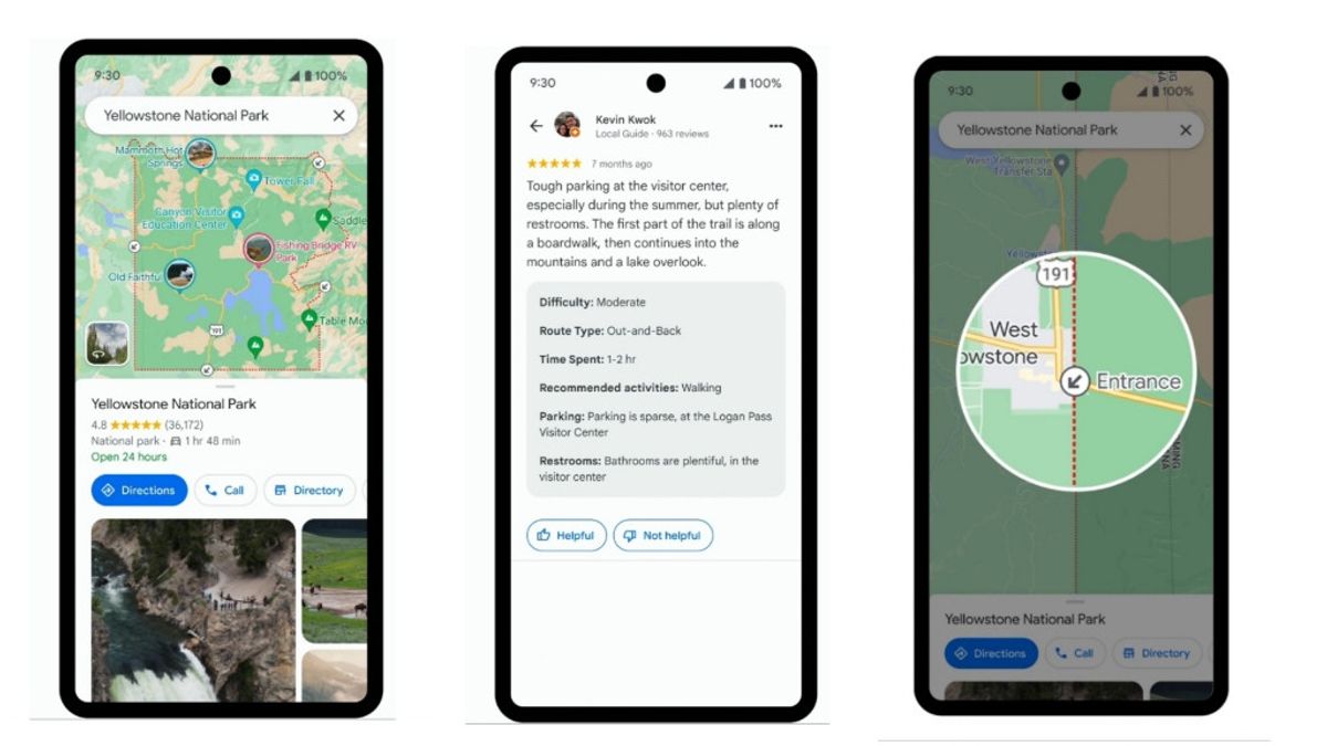
JAKARTA - This April, Google introduced four upcoming updates to Google Maps for iOS and Android, which will help users explore national parks more easily, through apps.
With this update, all the activities you can do in the park, from finding your way around the park to finding things to do while you're there will be available right in Maps.
Google says the feature is intended to help users more easily identify where a trail ends and begins, and what the route looks like.
First, users will now find it easier to identify popular places, including tourist attractions, and so on, with the help of the Maps community. When you browse the place, all you have to do is tap on the photo to see the video and the review.
Not only that, but Google will also show helpful details from the Maps community like the trail type, difficulty, and whether the trail is more suitable for running, walking, or cycling.
اقرأ أيضا:
Later this month, the search giant will also add information about where the entrance to the park or venue is, and even Maps will provide directions for walking or cycling to specific trails.
Once you've been traveling, there may be one place where you find it difficult to have reliable cellular signal coverage. Therefore, you can now download an offline map for a park.
Just tap the 'download' button in the Google Maps listing. This way you can easily find your way without internet access or mobile data. The download button will appear on park listings later this month.
Unfortunately, all of these new features will be presented to US users only this month. However, Google will be rolling out the same feature to parks around the world in the coming months.
The English, Chinese, Japanese, Arabic, and French versions are automatically generated by the AI. So there may still be inaccuracies in translating, please always see Indonesian as our main language. (system supported by DigitalSiber.id)


