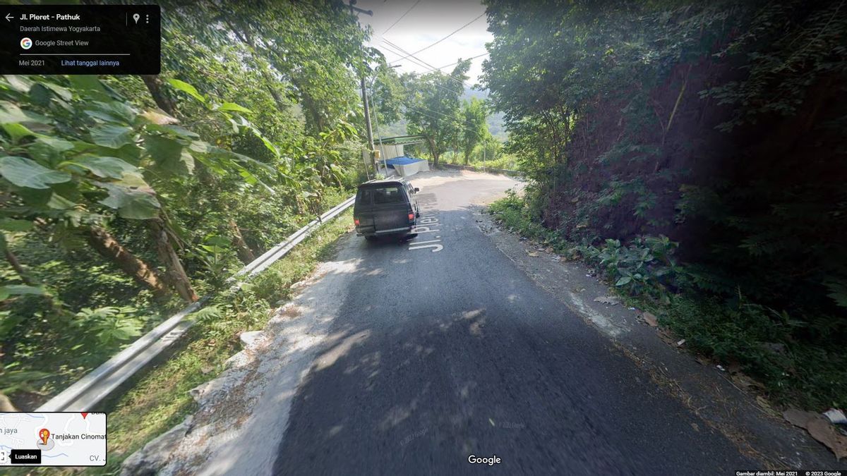
BANTUL-Polres Bantul, Special Region of Yogyakarta, has coordinated with related parties, including the Bantul Communications and Information Office and Google, to temporarily disable the Cinomati route from Google Maps during the Eid 2023 holiday. This step was taken as an effort to anticipate the potential for traffic accidents on the route which could occur due to the surge in homecoming flow and tourists during the Eid holiday period.
Bantul Police Chief, AKBP Ihsan, said that they had communicated with the Bantul Communications and Information Office and Google to temporarily remove the Cinomati direction from Google Maps during Eid leave.
This aims to avoid using the route by travelers who may be looking for alternative routes using digital map applications, which in turn can result in traffic jams and accidents.
"(The temporary abolition) During collective leave, after that we will reopen. We also prepare a monitoring post, because usually people pass there because they are used to it," said Police Chief Ihsan to reporters in Bantul on Monday (17/4/2023) night.
The Ihsan Police Chief also explained that the Bantul Police predicts that the spike in the flow of Eid homecoming will occur on D-3 Lebaran, and the surge in traffic flow in Bantul is expected to occur after Lebaran until D+3, when travelers will visit tourist attractions in Bantul Regency. Popular tourist destinations in Bantul, such as Parangtritis and Mangunan, are often the destinations of tourists during the Eid holiday.
Many tourists use Google Maps, or Waze, a roadmap application to get to these tourist attractions. The goal is of course to find the fastest and shortest path and as much as possible not to avoid traffic jams. This can be done by Google Maps and Waze by suggesting alternative routes.
Users of the map application can also report closed roads so that Google Maps and Waze ultimately don't recommend the road or notify users that the road is closed.
To inform that certain roads are closed on Google Maps, follow the following steps:
Your report will help other users who use Google Maps to find out that the road is closed and to find alternative routes. It will also help Google Maps update information regarding closed roads so that the information displayed in the app will be more accurate and up-to-date.
Here's how Waze users can report road closures:
After reporting road closures, the information will be seen by other Waze users around the road closure area and will provide alternative routes to avoid closed roads. Your report will also help the Waze navigation system to update closed road-related information and provide more accurate and up-to-date information for users in the future.
また読む:
Once you report road closures on Google Maps and Waze, your report will soon be received by the app. However, that information still needs to be verified before it is displayed on Google Maps and Waze apps. Google Maps relies on information from various sources to ensure the accuracy of the information displayed on its app, including reports from users like you.
The number of reports needed to update the information on Google Maps and Waze varies depending on the situation. If the information you report is verified and proven to be correct, then the information will be updated to the Google Maps and Waze apps soon. However, if there is confusing or controversial information, Google Maps may need additional reports before updating the information on its app.
In some cases, Google Maps can also check information from other sources, such as local governments, to ensure the accuracy of information before updating data on the app. Therefore, although the report you create can help, keep in mind that the time it takes to update information on Google Maps can vary depending on the situation.
The English, Chinese, Japanese, Arabic, and French versions are automatically generated by the AI. So there may still be inaccuracies in translating, please always see Indonesian as our main language. (system supported by DigitalSiber.id)


