Googluen even made a number of updates on Maps with Artificial Intelligence (AI) technology. This update includes many things, including navigation and directional directions.
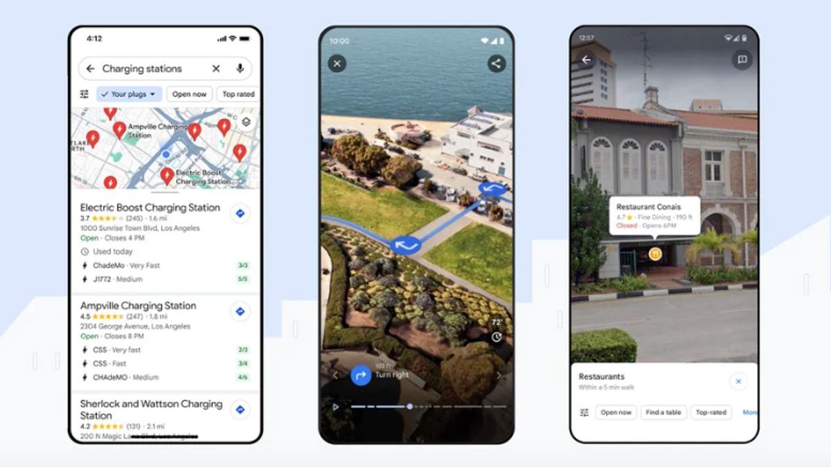
The first update described by VP and General Manager Chris Phillips is the Immersive View feature for the route. This feature can be used to review travel routes with multidimensional views.
This feature has emerged since the beginning of the year, but Google has only implemented it in several countries. Now, Immersive View is available in Amsterdam, Barcelona, Dublin, Florence, Las Vegas, London, Los Angeles, Miami, New York, Paris, San Francisco, San Jose, Seattle, Tokyo, and Venice.
Next, Google added the Lens feature in Maps, friends explore new areas with AI relevant reality (AR). This feature will make users better understand the surrounding situation and be able to adjust quickly.
To use this feature, users only need to tap the Lens icon in the search box, then point the phone at various buildings or places around to get information. This feature will be available in more than 50 cities this week.
Furthermore, Google updated a more accurate navigation map. In addition to its updated color, the building displayed is more realistic so that users can read Maps easily.
In addition to more accurate navigation, information on the speed limit per region is added. If users have difficulty finding a speed limit sign, Google Maps will now show it.
Both features will be available in the coming months on iOS and Android. However, a new navigation update will be available in 12 countries while the view of the speed limit is extended to 20 countries.
The next update is a feature added specifically to electric vehicle drivers. Now, electric car users don't have to worry about finding a place to charge nearby because Maps can display it.
Starting this week, electric vehicle drivers can see the nearest charging station information. Users can also find out if the charger is compatible and fast.
VOIR éGALEMENT:
The last update Google added was a search on Maps. Now, this app can provide answers to user questions and help in finding the right activity.
For example, when a user wants to spend time playing in a mall with a pet and doesn't know the right location, users can type candidly to play with dogs.
The search results will show an attractive image display that can be used as a place reference. When the image is tapped, Maps will immediately show the name and location.
Google will launch the alternative search feature this week. Some countries that will experience its updates are France, Germany, Japan, the UK and the United States.
The English, Chinese, Japanese, Arabic, and French versions are automatically generated by the AI. So there may still be inaccuracies in translating, please always see Indonesian as our main language. (system supported by DigitalSiber.id)


