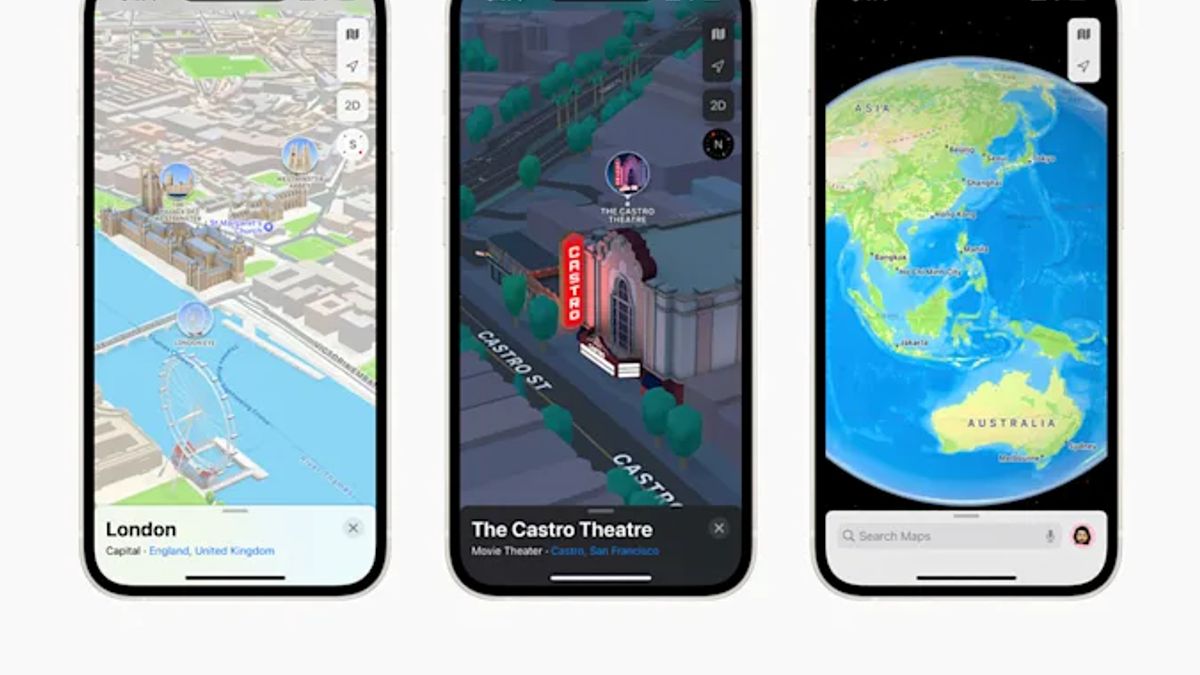


JAKARTA - Apple's new operating system, iOS 15, is the biggest update the company has ever made to Apple Maps. This update includes a fully 3D view of certain cities.
The 3D view is equipped with graphics and designs created to enhance one's experience when exploring new areas. From Apple's report, there are only four cities that support 3D viewing, namely London, Los Angeles, New York City, and the San Francisco Bay Area.
Apple plans to add the cities of Philadelphia, San Diego, and Washington DC in the next three months. Next year Canada will have a moment with more detailed maps coming to Montreal, Toronto, and Vancouver. This update also features a 3D version of the Statue of Liberty and the London Eye Pier.
"Now even the most remote and valuable locations on the planet can be explored right from the iPhone," said Apple as quoted from Slashgear, Tuesday, September 28.

At night, the Statue of Liberty is beautifully lit against the backdrop of a dark night. Not only famous scenery with 3D appearance. Other parts of the city are also shown with similar realistic details such as the city center, harbor, waterfront, and office buildings.
With this 3D map view, it is very interesting that Apple intends to take its users around the world virtually. This 3D Apple Maps is reminiscent of the Niantic system, which also uses 3D scanning, and was captured by photogrammetry by Pokemon GO players and similar titles.
For information, Apple's 3D display system with 3D architecture is made piece by piece. Also introduced is a 3D globe in Apple Maps iOS 15. Allows users to navigate the Earth with added textures and contours. From the globe, you will see areas that are displayed in 3D, while areas that do not support will appear as usual.
SEE ALSO:
-
 | TEKNOLOGI
Chili Berencana Terbitkan Peso Digital untuk Imbangi Penetrasi Kripto
28 September 2021, 08:30 -
 | TEKNOLOGI
Perusahaan Retail di China Bakal Gunakan Robot Lebih Banyak dalam Pengiriman Barang
28 September 2021, 08:00 -
 | TEKNOLOGI
Ini 9 Bocoran Fitur Kamera Google Pixel 6 dan Pixel 6 Pro Terbaru
28 September 2021, 03:03


The Cupertino, US giant says the app will soon offer improved navigation via CarPlay. Public transport riders may find it easier to get around as well. If users enter their route, the app can tell them when it's time to get off the bus or subway.
It doesn't stop there, iOS 15 also brings other futuristic features to Apple Maps, such as directions with AR, 3D views for certain routes, cycling directions, incident reports, and flyover views.
The English, Chinese, Japanese, Arabic, and French versions are automatically generated by the AI. So there may still be inaccuracies in translating, please always see Indonesian as our main language. (system supported by DigitalSiber.id)


