

The Public Works and Spatial Planning (PUPR) of Temanggung Regency stated that the handling of the Galeh River cliff landslide was carried out together between districts, provinces and the center.
The landslide threatens the national road that connects Temanggung with Wonosobo Regency in Catgawen, Parakan
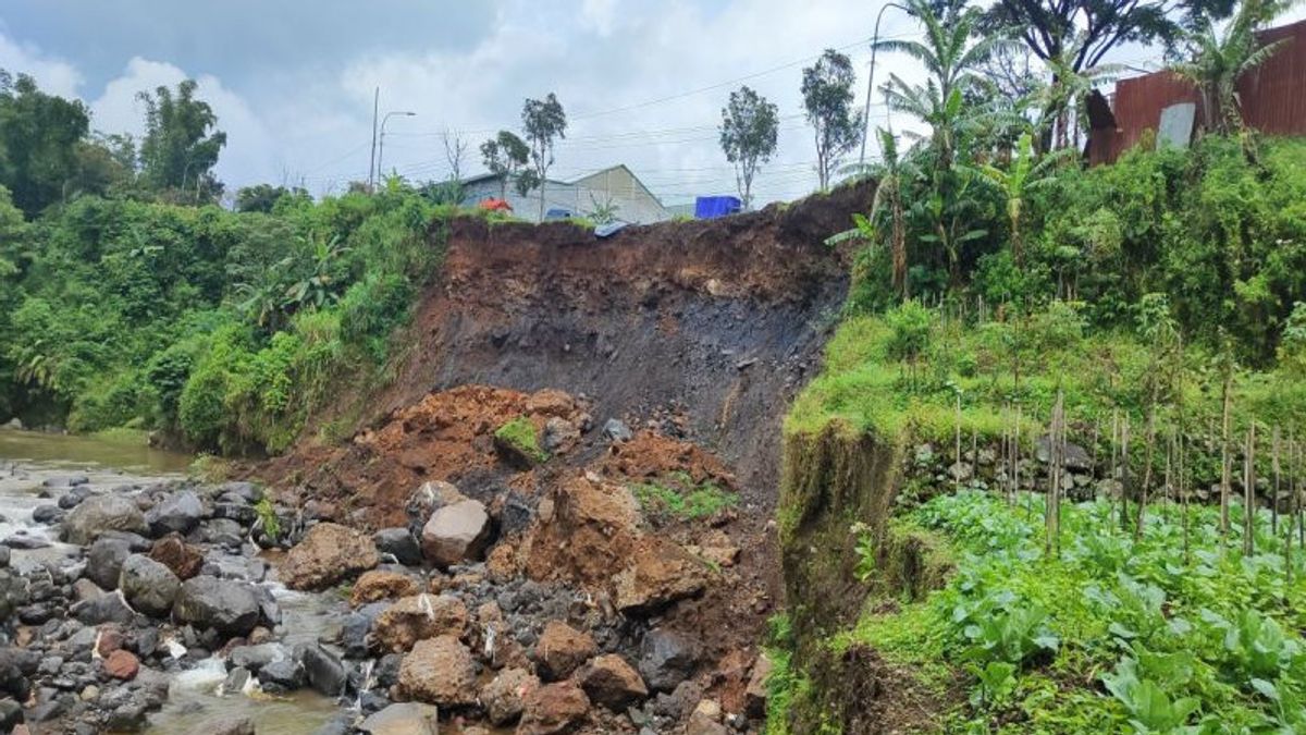
"The landslide land in Catgawen Parakan is an asset of a national road, then the cause is flooding in the Galeh River," said the Temanggung Regency Public Works and Spatial Planning (DPUPR) Hendy Wahyu Noerhidayat in Temanggung, Thursday, March 20, which was confiscated by Antara.
He conveyed that his party had coordinated with the Serayu Opak River Basin Center (BBWS) which handled the river.
"Regarding the handling, it will indeed be strengthened by a cliff in the form of a sheet pile (SSP) by BBWS Serayu Opak, but now the process is just a delivery so that maybe after Lebaran it can only be executed," he said.
He said that before Lebaran, he was indeed trying to handle it temporarily, later while waiting for SSP.
"Some provide tarpaulins, sandbags, some provide power, some provide sand and truck dams, all of them have been divided. We have been carrying out temporary handling there for two days," he said.
SEE ALSO:


SEE ALSO:
He hopes that during the Lebaran homecoming, his condition will remain safe so that the national road will continue to function properly.
The cliff that collapsed was about five meters away, which was the road that connected Temanggung with Wonosobo.
The English, Chinese, Japanese, Arabic, and French versions are automatically generated by the AI. So there may still be inaccuracies in translating, please always see Indonesian as our main language. (system supported by DigitalSiber.id)
Most Popular Tags
#Prabowo Subianto #donald trump #2026 World Cup #Febrie Adriansyah #8791Popular


