JAKARTA - The Geospatial Information Agency (BIG) will immediately update data related to land subsidence along the north coast of Java, starting from the Jakarta Province area.
Deputy for Basic Geospatial Information (IGD) BIG Mohamad Arief Syafi i said, to strengthen efforts to measure the land subsidence, BIG has established a number of additional Ina-CORS (Continuous Operating Reference Station) stations. One new Ina-CORS station was founded by the BIG team in the Mangrove Angke Kapuk Park area, Pantai Indah Kapuk 2 (PIK), North Jakarta and began operating this December.
"There are also several other areas in all areas that we have previously installed CORS station which is used to monitor the rate of land subsidence," he said in Jakarta, Sunday, December 8, which was confiscated by Antara.
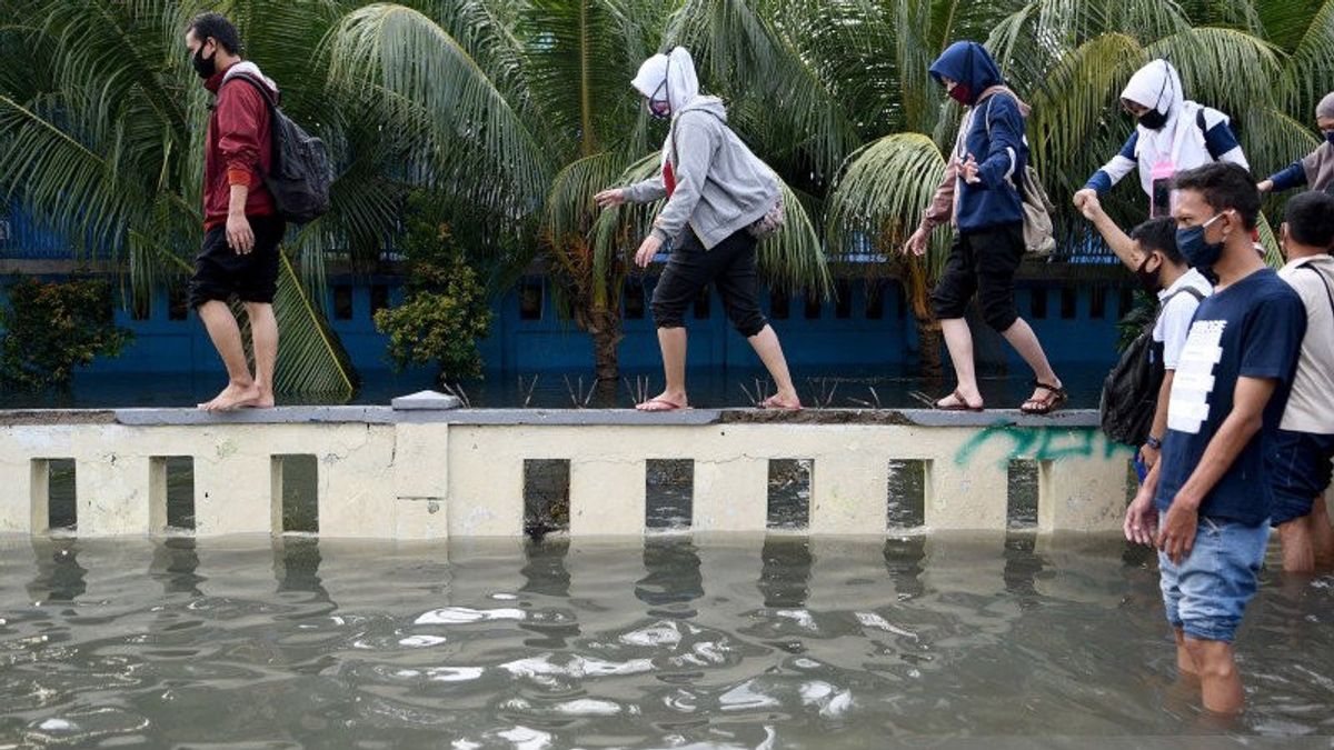
Based on a study by a team of geodesic experts, it was found that the coastal area of North Jakarta was one of the coastal areas north of Java, which experienced land subsidence, estimated to have reached four meters for five decades from 1975.
He explained that from previous studies, the rate of land subsidence on the north coast of Java was quite high, namely 10-15 centimeters per year or 1.5 meters in 10 years.
"Not only that, but the BIG team also found an increase in sea level of 3-4 millimeters per year, although small but the rate of increase took place at night but it was definitely in the coastal area north of Java. Including there (Angke Kapuk mangroves) during the afternoon high tides, the height has reached as high as adults," he said.
SEE ALSO:
Arief ensured, as the guardian of Indonesia's geospatial data, the BIG ground level measurement has a high level of accuracy because it already uses equipment such as Ina-CORS and is strengthened by InSAR or Interometric Synthetic Aperture Radar. The combination of qualified technology equipment can provide differential correction data from several meters to millimeters.
"So we will detail the results with a larger scale map, 1: 5,000 so that all of them will be detected. This is being implemented by BIG and God willing, we will immediately publish the results," he said.
He hopes that the results of the research conducted by this BIG expert team can be a new reference for the development direction carried out by the government, as well as the community in overcoming the potential danger of land subsidence, tidal flooding, abrasion, and so on due to faster global climate change.
The English, Chinese, Japanese, Arabic, and French versions are automatically generated by the AI. So there may still be inaccuracies in translating, please always see Indonesian as our main language. (system supported by DigitalSiber.id)


