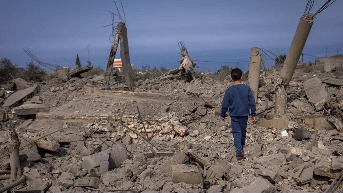


JAKARTA - Israel's military operations in southern Lebanon have caused major destruction in more than a dozen border cities and villages, making many of them a collection of gray craters, according to satellite imagery of Planet Labs Inc.
Many of the cities, which were empty of their population as a result of the bombing, have been inhabited by at least two centuries.
The image reviewed includes cities between the Kfarkela in southeastern Lebanon, to the south past Meiss al-Jabal, and then to the west past the base used by UN peacekeeping forces to the small village of Labbouneh.
"There are beautiful old houses, hundreds of years old. Thousands of artillery shells hit the city, hundreds of airstrikes," said Abdulmonem Choukeir, Mayor of Meiss al-Jabal, one of the villages affected by the Israeli attack.
Reuters compared satellite images taken in October 2023 with satellite images taken in September and October 2024.
Many villages that have suffered severe damage over the past month have been at the top of the hill overlooking Israel.
After nearly a year of gunfights across the border, Israel stepped up its attacks in southern Lebanon and its surroundings over the past month.
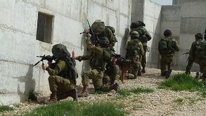
Israeli forces have carried out ground attacks along the mountainous border with Lebanon, involved in fierce clashes with Hezbollah fighters in several cities.
Lebanese disaster risk management unit, which tracks casualties and attacks in certain cities, said 14 cities reviewed by Reuters had been targeted by 3,809 Israeli attacks over the past year.
SEE ALSO:
-
 | BERITA
Tentara Israel Tangkap 100 Militan Hamas saat Kepung Rumah Sakit Kamal Adwan Gaza
28 Oktober 2024, 19:21

The Israeli military has not yet responded to Reuters' question about the scale of the devastation. Israeli military spokesman Daniel huhi said on October 24 Israel had attacked more than 3,200 targets in southern Lebanon.
The military said it attacked cities in southern Lebanon because Hezbollah had turned civilian villages into fortified combat zones, hiding weapons, explosives and vehicles there.
Hezbollah denied using civilian infrastructure to launch attacks or store weapons, and city residents denied the statement.
A person familiar with Israel's military operations in Lebanon told Reuters troops systematically attacked cities with strategic points, including Mhaibib.
Israel is said to have mapped after its final war with Hezbollah in 2006, including an incident in which troops carrying out ground attacks on valleys-valleys in southern Lebanon were attacked by Hezbollah fighters at the top of the hill.
That's why they're so targeting these villages so much that they can move more freely, the source said.
The latest picture of the Kfarkela shows a series of white spots along the main road to the city. The image taken last year shows the same road filled with green houses and plants, indicating that the houses have been destroyed.
Further south, Meiss al-Jabal, a city 700 meters from the UN-bounded Blue Line separating Israeli and Lebanese territory, was badly damaged in all blocks near the city center.
The area, measuring about 150 meters by 400 meters, appears in the form of brown sand sheets, indicating the building there has been completely flattened. Images from the same month in 2023 show a dense residential environment.
The English, Chinese, Japanese, Arabic, and French versions are automatically generated by the AI. So there may still be inaccuracies in translating, please always see Indonesian as our main language. (system supported by DigitalSiber.id)
Most Popular Tags
#Prabowo Subianto #donald trump #2026 World Cup #venezuela #konflik timur tengahPopular


