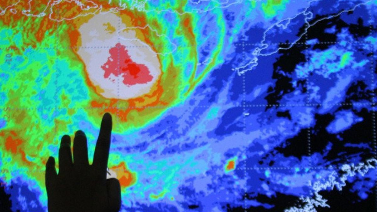


JAKARTA - The Meteorology, Climatology and Geophysics Agency (BMKG) predicts that Seroja Tropical Cyclone will experience an increase in intensity in the next 24 hours. This cyclone triggered floods in East Nusa Tenggara (NTT) some time ago.
The BMKG analyzes, the position of the tropical cyclone Seroja today at 01.00 a.m. local time is in the Indian Ocean region south of West Nusa Tenggara, 12.3 South Latitude, 118.8 East Longitude or about 335 kilometers south-southwest of Waingapu.
"Then the direction of the cyclone's motion was observed away from Indonesia's territory towards the southwest at a speed of 6 knots or 10 kilometers per hour", said the Head of the National Board for Disaster Management (BNPB) Disaster Office, Raditya Jati, in his statement, Wednesday, April 7.
Raditya said that the strength of this tropical cyclone reaches 35 knots or 65 kilometers per hour with a pressure of 995 hPa.
Then, the BMKG predicts the position of the cyclone movement will tend to the Indian Ocean south of Bali, 14.4 LS, 115.7 East Longitude, or about 730 kilometers southwest of Waingapu and away from Indonesian territory.
"The strength of this cyclone also strengthens to 40 knots or 75 kilometers per hour with a pressure of 994 hPa", he said.
SEE ALSO:
-
 | BERITA
Bupati Lembata Tetapkan Status Tanggap Darurat Bencana hingga 17 April
07 April 2021, 08:28
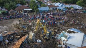
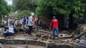
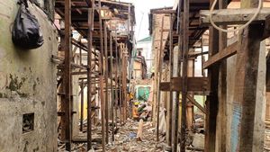

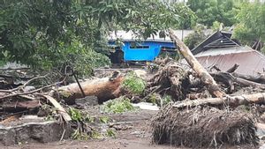
The cyclone condition that will increase is indeed likely to stay away from Indonesian territory. However, the potential for rain with moderate to heavy intensity accompanied by lightning and strong winds can occur in the regions of Central Java, DI Yogyakarta, East Java, Bali, West Nusa Tenggara, and East Nusa Tenggara.
In addition, the BMKG also predicts that the impact of the cyclone will also trigger waves as high as 2.5-4.0 meters in the western waters of Lampung, the western Indian Ocean, Lampung, the southern Sunda Strait, the southern waters of Java Island to West Nusa Tenggara (NTB), the southern Indian Ocean, Java Island to Bali, Southern waters from Sumba Island to Rote Island.
Furthermore, waves as high as 4.0-6.0 meters are likely to occur in the waters south of NTB to southern P. Sumba.
"Seeing the results of the analysis and extreme weather forecasts from the BMKG, it is hoped that regional policymakers can increase their capacity and take necessary actions to mitigate and reduce disaster risks in the future", he concluded.
The English, Chinese, Japanese, Arabic, and French versions are automatically generated by the AI. So there may still be inaccuracies in translating, please always see Indonesian as our main language. (system supported by DigitalSiber.id)
Most Popular Tags
#Prabowo Subianto #donald trump #Febrie Adriansyah #8791 #giias 2026Popular


