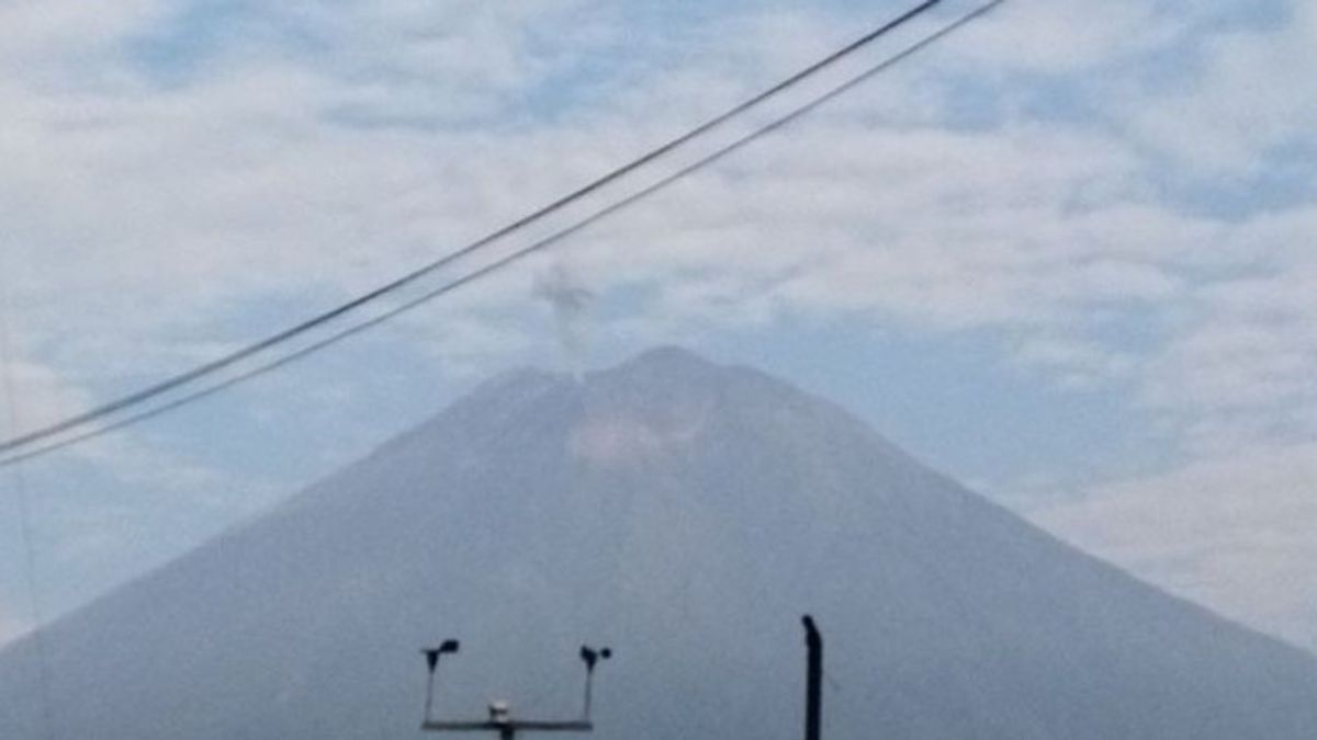


JATIM - The activity of Mount Semeru is still dominated by eruptions or eruptions in the last few days in the fourth week of September 2024.
Mount Semeru Observation Post officer Ghufron Alwi said that for 24 hours on Thursday, September 26, there were 3,676 meters above sea level, 72 earthquakes with an amplitude of 10-23 mm and a long earthquake of 60-187 seconds.
"Then four avalanches with an amplitude of 3-10 mm, 13 gusts with an amplitude of 2-8 mm, 5 times harmonic with an amplitude of 2-10 mm, one volcanic earthquake, and four tectonic earthquakes," he said in a written statement in Lumajang, Friday, September 27, confiscated by Antara.
On Wednesday, September 25, there were 66 eruption/eruption earthquakes with an amplitude of 12-22 mm, and an earthquake of 60-178 seconds, 11 gusts, 14 harmonics, 1 local tectonic earthquake.
Mount Semeru was recorded several eruptions on Friday morning starting at 00.41 WIB, at 00.52 WIB, at 00.56 WIB, at 01.27 WIB, at 01.11 WIB, at 01.31 WIB, and at 05.18 WIB, but the visual eruption was not observed.
SEE ALSO:
-
 | BERITA
Ketua DPRD Dipanggil KPK Terkait Dugaan Korupsi di Pemkot Semarang
26 September 2024, 16:14 -
 | BERITA
PDIP: Pergantian dan Pemecatan Tia dan Rahmad dari Anggota DPR karena Perselisihan Suara Pileg
26 September 2024, 13:24 -
 | BERITA
Angka Bunuh Diri di AS Melonjak, Senjata Api Paling Banyak Digunakan
26 September 2024, 16:02 -
 | BERITA
Korsel Beri Intensif Pelaku Usaha Jual Beli Daging Anjing Rp1,13 Triliun untuk Gulung Tikar
26 September 2024, 15:06 -
 | BERITA
1.338 Bahan Peledak Bahayakan Warga Yaman Dibersihkan Proyek Masam Arab Saudi
26 September 2024, 14:04 -
 | BERITA
Pekerja di India Ramai Tukar Cerita soal Tempat Kerja Toxic Buntut Kematian Karyawan Wanita
26 September 2024, 13:14

Ghufron explained that Mount Semeru is still on alert status, so the Center for Volcanology and Geological Hazard Mitigation (PVMBG) provides a number of recommendations, namely that people are prohibited from carrying out any activity in the southeast sector along Besuk Kobokan as far as eight kilometers from the summit (the center of the eruption).
Then outside of that distance, he said, people are not allowed to carry out activities at a distance of 500 meters from the riverbank (river border) along Besuk Kobokan, because it has the potential to be affected by the expansion of hot clouds and lava flows up to a distance of 13 km from the summit.
The community is also not allowed to move within a three km radius of the crater/peak of Mount Semeru, because it is prone to the danger of throwing stones (lightning).
In addition, he said, it is necessary to be aware of the potential for hot clouds, lava avalanches, and lahars along rivers/valleys that originate at the top of Mount Semeru, especially along Besuk Kobokan, Besuk Bang, Besuk Kembar, and Besuk Sat, as well as the potential for lava in small rivers that are tributaries from Besuk Kobokan.
The English, Chinese, Japanese, Arabic, and French versions are automatically generated by the AI. So there may still be inaccuracies in translating, please always see Indonesian as our main language. (system supported by DigitalSiber.id)


