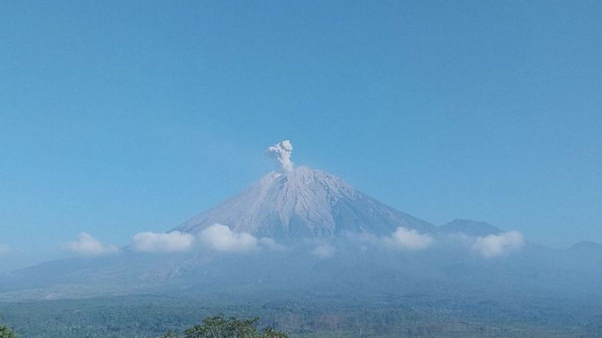


This Saturday at 07.45 WIB, Mount Semeru, which is on the border of Lumajang and Malang Regencies, East Java, erupted again with an eruption as high as 800 meters or 4,476 meters above sea level (masl).
"The ash column was observed to be white to gray with thick intensity to the south and southwest. The eruption was recorded on a seismograph with a maximum amplitude of 23 mm and a duration of 97 seconds," said Mount Semeru Observation Post Officer Sigit Rian Alfian in a written statement received in Lumajang, as reported by Antara, Saturday, July 27.
Based on officer data, Mount Semeru was recorded as having six eruptions on Saturday from 00.00 to 08.00 WIB, with the first eruption occurring at 00.43 WIB, but the visual eruption was not observed because it was covered in fog.
Then, the eruption erupted again at 01.23 WIB and the eruption visual was not observed, even when the report was made by officers, the eruption activity was still ongoing.
At 05.38 WIB, the mountain, which has an altitude of 3,676 meters above sea level, erupted again with a height of volcanic ash eruptions observed about 400 meters above the peak and a column of ash was observed to be white to gray with moderate to southwest intensity.
A few minutes later or to be precise at 05.47 WIB, Mount Semeru erupted with a height of volcanic ash column observed about 300 meters above the peak and a column of ash was observed to be white to gray with moderate intensity to the south.
The fifth eruption occurred at 06.32 WIB with a column height of ash observed about 600 meters above the peak and a column of ash was observed to be white to gray with thick intensity to the southwest and west. The eruption was recorded on the seismograph with a maximum amplitude of 16 mm and a duration of 76 seconds.
"There was another Semeru eruption at 07:45 WIB with a column height of ash observed about 800 meters above the peak or 4,476 meters above sea level," said Sigit.
SEE ALSO:


According to him, the ash column was observed to be white to gray with thick intensity to the south and southwest. This eruption was recorded on a seismograph with a maximum amplitude of 23 mm and a duration of 97 seconds.
He explained that Mount Semeru has Alert status or Level II, so that the Center for Volcanology and Geological Hazard Mitigation (PVMBG) provides a number of recommendations, namely that people are prohibited from carrying out any activities in the southeast sector along Besuk Kobokan, as far as 8 km from the summit (the center of the eruption).
Beyond that distance, he continued, people are not allowed to carry out activities at a distance of 500 meters from the riverbank (river border) along Besuk Kobokan, because it has the potential to be affected by the expansion of hot clouds and lava flows up to a distance of 13 km from the summit.
The community is also not allowed to move within a 3 km radius of the crater/peak of Mount Semeru because it is prone to the danger of throwing stones (pijar).
In addition, it is necessary to be aware of the potential for hot clouds, lava avalanches, and lahars along rivers/valleys that originate at the peak of the Semeru Volcano, especially along Besuk Kobokan, Besuk Bang, Besuk Kembar, and Besuk Sat as well as the potential for lahars in small rivers which are tributaries of Besuk Kobokan.
The English, Chinese, Japanese, Arabic, and French versions are automatically generated by the AI. So there may still be inaccuracies in translating, please always see Indonesian as our main language. (system supported by DigitalSiber.id)


