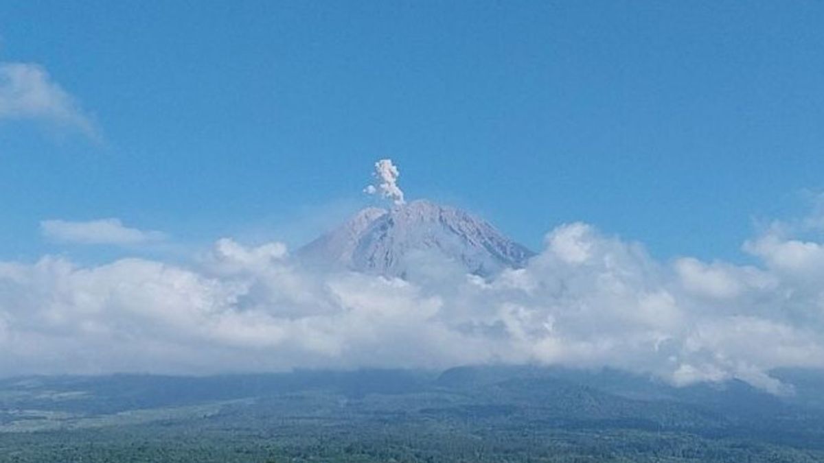


Mount Semeru in Lumajang Regency, East Java, which has a height of 3,676 meters above sea level (masl) was recorded to have experienced three eruptions on Tuesday, July 23 morning.
The first eruption occurred at 00.42 WIB with visually an eruption not being observed because it was covered in fog, then the eruption occurred again at 05.20 WIB and the eruption visual was not observed. When the report was made, the eruption was still ongoing.
"The eruption of the highest mountain on the island of Java occurred again at 06.01 WIB, but the visual eruption was not observed because it was covered in fog," said Mount Semeru Observation Post Officer Liswanto in a written report received quoted by ANTARA, Tuesday, July 23.
Based on reports from the earthquake observations of Mount Semeru for 24 hours on Monday, July 22, 46 earthquakes were recorded with an amplitude of 11-23 mm and an earthquake of 45-127 seconds.
Then recorded 45 avalanches with an amplitude of 1-8 mm and an earthquake length of 29-110 seconds, as many as 20 earthquake gusts with an amplitude of 2-7 mm and an earthquake length of 25-80 seconds, as well as five distant tectonic earthquakes with an amplitude of 5-22 mm, S-P 12-18 seconds and an earthquake length of 29-47 seconds.
Mount Semeru has the status of Alert or Level II, so that the Center for Volcanology and Geological Hazard Mitigation (PVMBG) provides a number of recommendations, namely that people are prohibited from carrying out any activities in the southeast sector along Besuk Kobokan, as far as 8 km from the summit (the center of the eruption).
SEE ALSO:


Beyond that distance, he continued, people are not allowed to carry out activities at a distance of 500 meters from the riverbank (river border) along Besuk Kobokan because it has the potential to be affected by the expansion of hot clouds and lava flows up to a distance of 13 km from the summit.
The community is also not allowed to move within a 3 km radius of the crater/peak of Mount Semeru because it is prone to the danger of throwing stones (pijar).
In addition, it is necessary to be aware of the potential for hot clouds, lava avalanches, and lahars along rivers/valleys that originate at the peak of the Semeru Volcano, especially along Besuk Kobokan, Besuk Bang, Besuk Kembar, and Besuk Sat as well as the potential for lahars in small rivers which are tributaries of Besuk Kobokan.
PVMBG released that the status of Mount Semeru has dropped from Alert or Level III to Alert or Level II since July 15, 2024 at 15.00 WIB based on the results of a thorough evaluation and analysis.
The English, Chinese, Japanese, Arabic, and French versions are automatically generated by the AI. So there may still be inaccuracies in translating, please always see Indonesian as our main language. (system supported by DigitalSiber.id)


