

JAKARTA - The Center for Volcanology and Geological Hazard Mitigation (PVMBG) announced the latest status of Mount Ibu on Halmahera Island, North Maluku, is now no longer vigilant or level IV but has dropped to alert or level III.
"The results of visual and instrumental monitoring show a decline in volcanic activity," said PVMBG Head Hendra Gunawan in a report quoted by ANTARA, Friday, June 21.
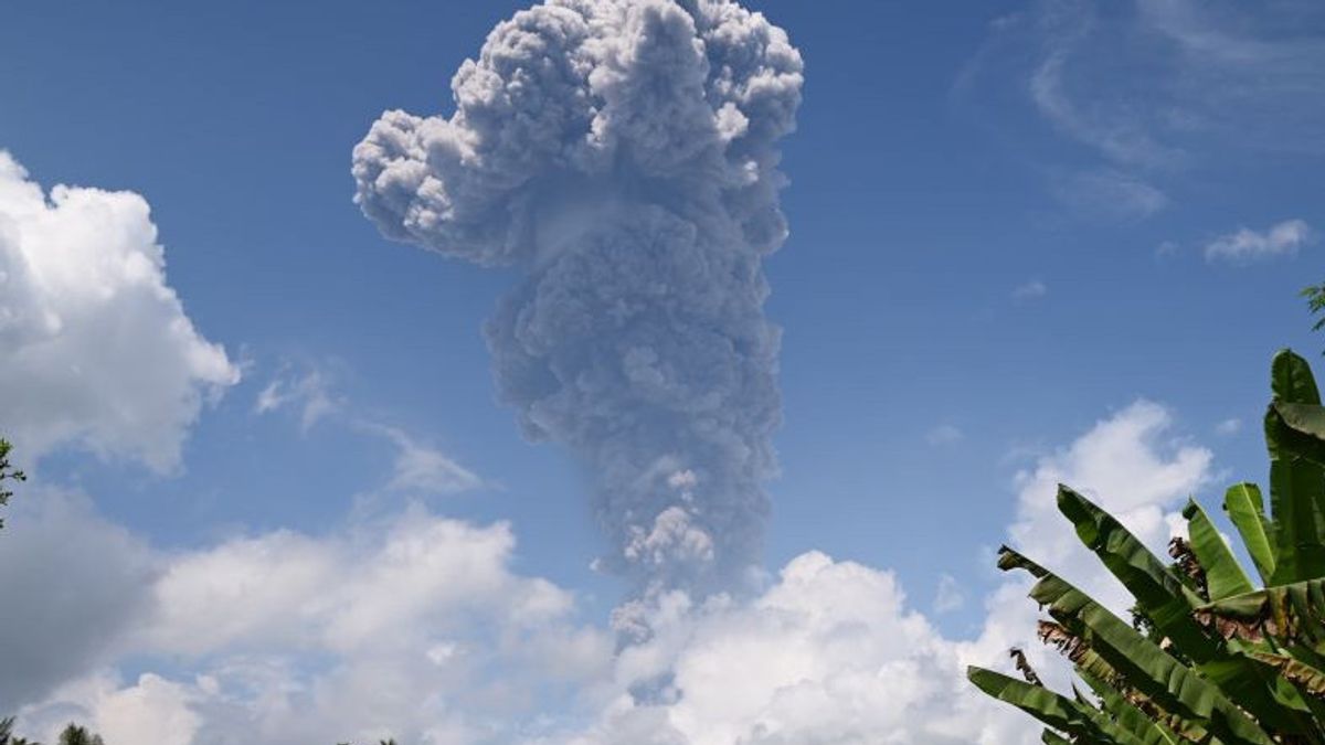
The results of visual observations for the period 1-20 June 2024 showed that the main crater smoke was white, gray, brown, and black with a thin, medium to thick intensity of approximately 100 to 7,000 meters from the summit.
The weather was sunny to rainy conditions, weak to strong winds to the north, northeast, east, southeast, south, southwest, west, and northwest.
Meanwhile, instrumental observations are dominated by shallow volcanic earthquakes, eruption earthquakes, gusts, and distant tectonic earthquakes that still occur every day.
During the period 1-20 June 2024, PVMBG recorded 52 eruption earthquakes, 2 avalanches earthquakes, 1,351 gusts, 192 harmonic earthquakes, 13 non-harmonic tremors, 5 tornillo earthquakes, 14,681 shallow volcanic earthquakes, 852 deep volcanic earthquakes, 27 local tectonic earthquakes, 1 earthquake was felt (I MMI scale), and 284 distant tectonic earthquakes.
On June 1 and 2, 2024, visual activity and seismicity, especially deep volcanic earthquakes and shallow volcanic earthquakes, were still high. A series of intense shallow earthquakes indicate an increase in pressure due to magma migration into shallow ones.
The height of the eruption column also increased to reach 7,000 meters from the crater of the summit. The eruption accompanied by incandescent lava hit a radius of about 2 kilometers from the crater's lips, accompanied by rumbling sounds and crashings to the observation post of Mount Ibu.
SEE ALSO:
-
 | BERITA
Panggil Dubes Rusia, Korsel Minta Kerja Sama Militer dengan Korut Dihentikan
21 Juni 2024, 19:28


Starting June 15, 2024, the number of seismicities recorded and the height of the eruption column began to decline. The eruption incident accompanied by incandescent lava has also begun to decrease, and the screening distance is also decreasing, which is within a radius of 1 kilometer from the crater's lips.
Based on observations in the field, the potential hazards that may occur are incandescent lava, eruptive hot clouds (if the lava dome is destroyed or exposed), hot clouds avalanche (if the eruptive material that accumulates on the crater's lips is unstable), and lava flows that have been observed in the river that passes through Togarebasungi Village, Totokoke Village, Barona Village, Naga Village, Togowo Village, and Togerebotua Village.
"People around Mount Ibu and visitors or tourists should not move, climb, and approach Mount Ibu within a radius of 4 kilometers and sectoral 5 kilometers from the direction of the crater opening in the north of the active crater," Hendra said.
The English, Chinese, Japanese, Arabic, and French versions are automatically generated by the AI. So there may still be inaccuracies in translating, please always see Indonesian as our main language. (system supported by DigitalSiber.id)
Most Popular Tags
#Prabowo Subianto #donald trump #2026 World Cup #venezuela #konflik timur tengahPopular


