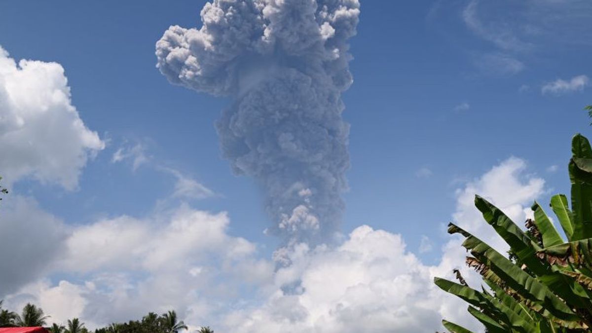


The Geological Agency of the Ministry of Energy and Mineral Resources (ESDM) has compiled a modeling of the Mount Ibu lava on Halmahera Island, North Maluku, to find out the reach and distribution of lahars in the event of lava flooding in the volcano with alert status.
Head of the Center for Volcanology and Geological Hazard Mitigation (PVMBG) Hendra Gunawan said the modeling used the HL-Cone method to get the starting point for the formation of lava on Mount Ibu.
"The initial points obtained are then modeled for each river flow, assuming a volume of 300 thousand cubic meters and 500 thousand cubic meters," said Hendra as quoted by ANTARA, Friday, June 14.
The volume assumption is used because the material volume data from the measurement results does not yet exist. The modeling of the lava does not take into account the speed and travel time of the lava.
Hendra said that from the results of the modeling that was prepared, it showed that lava flow did not only occur along the river flow, but in several rivers the lava flow overflowed to plantation areas that had morphologies such as river valleys.
Even in several locations, he continued, the lava flow of Mount Ibu also hit locations where there were buildings.
The results of the modeling are then compiled with data on building infrastructure obtained from the National Disaster Management Agency (BNPB) to obtain information on the estimated number of buildings affected by lava in each village.
Several river valleys that have the potential for lahars from the modeling results are not illustrated in the Mount Ibu Disaster Prone Area Map (KRB).
This is due to differences in the use of basic maps, where the Mount Ibu KRB Map is based on the Indonesian Earth Map (RBI), while lahar modeling uses data on elevations from the Digital Elevation Model National (Demnas).
According to Hendra, the rivers and river valleys in the results of lahar modeling that have been compiled with the Mount Ibu KRB map are flows that have the potential to be affected by lava flows.
"The compilation of lahar modeling and the map of Mount Ibu KRB can be used as a reference in mitigating the potential for lava flooding on Mount Ibu," he said.
Hendra said that the modeling of lahars would be more accurate if it was equipped with the latest DEM/DTM data.
SEE ALSO:


Lahar landing in places that are not included in the modeling does not rule out the possibility that there will be a change in morphology between the Demnas time span used and the current conditions.
Mount Ibu is a strato-type volcano and has a peak height of 1,340 meters above sea level (masl) which is administratively included in the area of Ibu District, West Halmahera Regency, North Maluku Province.
Since May 16, 2024 until today, Mount Ibu is still in Alert status or Level IV because volcanic and seismic activity is still relatively high.
The Geological Agency made visual and instrumental observations of the volcanic observation post located in Gam Ici Village, Ibu District, West Halmahera Regency, North Maluku.
The English, Chinese, Japanese, Arabic, and French versions are automatically generated by the AI. So there may still be inaccuracies in translating, please always see Indonesian as our main language. (system supported by DigitalSiber.id)
Most Popular Tags
#Prabowo Subianto #donald trump #2026 World Cup #venezuela #konflik timur tengahPopular


