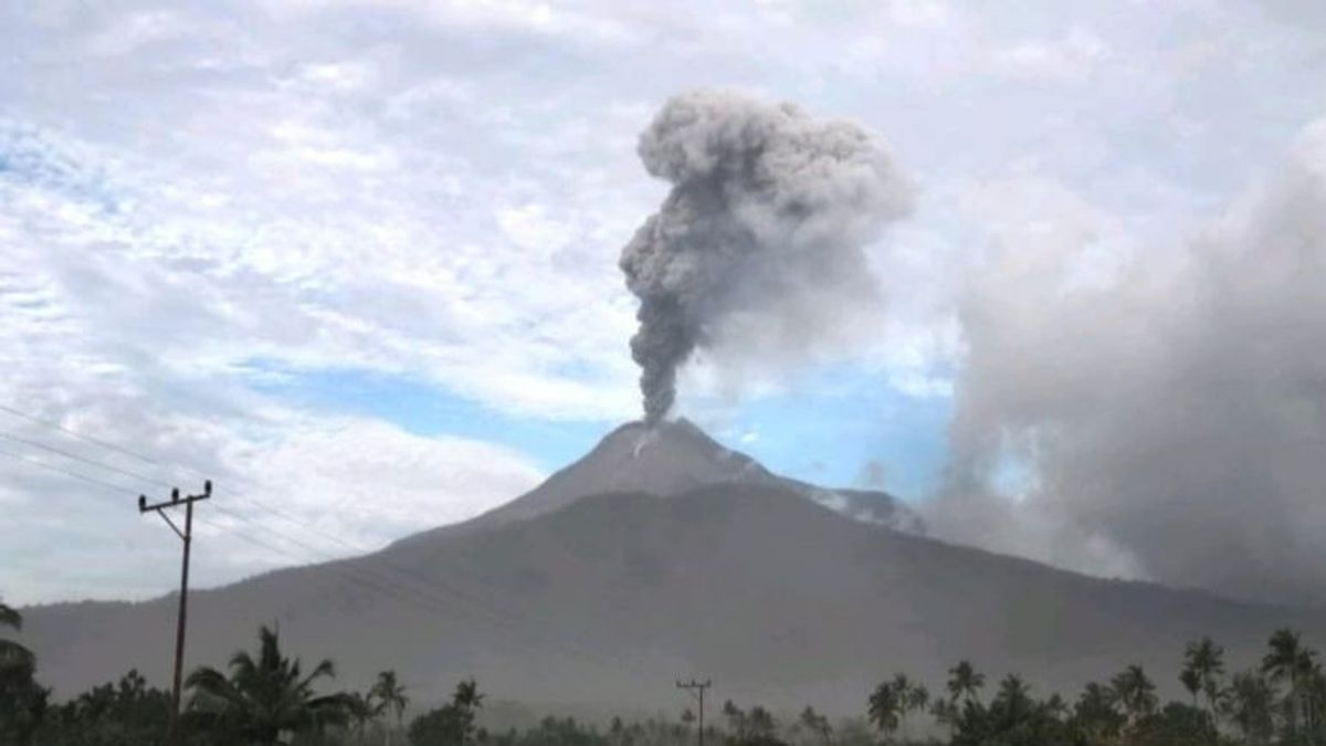


JAKARTA - The National Disaster Management Agency (BNPB) stated that the danger zone for the eruption of Mount Lewotobi Laki, East Flores, East Nusa Tenggara, is at a radius of two kilometers.
Head of the BNPB Disaster Data, Information and Communication Center Abdul Muhari said the public was expected not to carry out any activities at the specified radius.
The BNPB Pusdalops confirmed that joint officers had been alerted at the location to provide a sense of security to the people around the volcano with a height of 1,584 meters.
The joint officers, he said, also socialized to the public to always wear masks or mouth coverings to avoid the dangers of volcanic ash in the respiratory system.
SEE ALSO:
-
 | BERITA
Biden Anggap Netanyahu Bisa Perpanjang Perang di Gaza Demi Tujuan Politik
04 Juni 2024, 20:28 -
 | BERITA
Kebakaran Besar Terjadi di Israel Utara Usai Tembakan Roket dari Lebanon
04 Juni 2024, 18:56


The Geological Agency of the Ministry of Energy and Mineral Resources (ESDM) recorded the eruption of Mount Lewotobi Laki five times on Tuesday from 01.00 WITA to 16.06 WITA.
The Volcano Observation Post (PGA) of the Geological Agency recorded the latest eruption activity that occurred at 16.06 WITA throwing ash up to 800 meters above the peak.
The ash column was observed to be gray with thick intensity leaning towards the southwest and west. The eruption was recorded on a seismogram with a maximum amplitude of 47.3 mm with a duration of about 6 minutes 41 seconds, so far Mount Lewotobi has level II (Awas) status by the Geological Agency.
The English, Chinese, Japanese, Arabic, and French versions are automatically generated by the AI. So there may still be inaccuracies in translating, please always see Indonesian as our main language. (system supported by DigitalSiber.id)
Most Popular Tags
#Prabowo Subianto #donald trump #2026 World Cup #Febrie Adriansyah #8791Popular


