

JAKARTA - The Center for Volcanology and Geological Hazard Mitigation (PVMBG) has expanded the recommendation distance for Mount Ruang in Sitaro Islands Regency, North Sulawesi, from the previous six kilometers to seven kilometers.
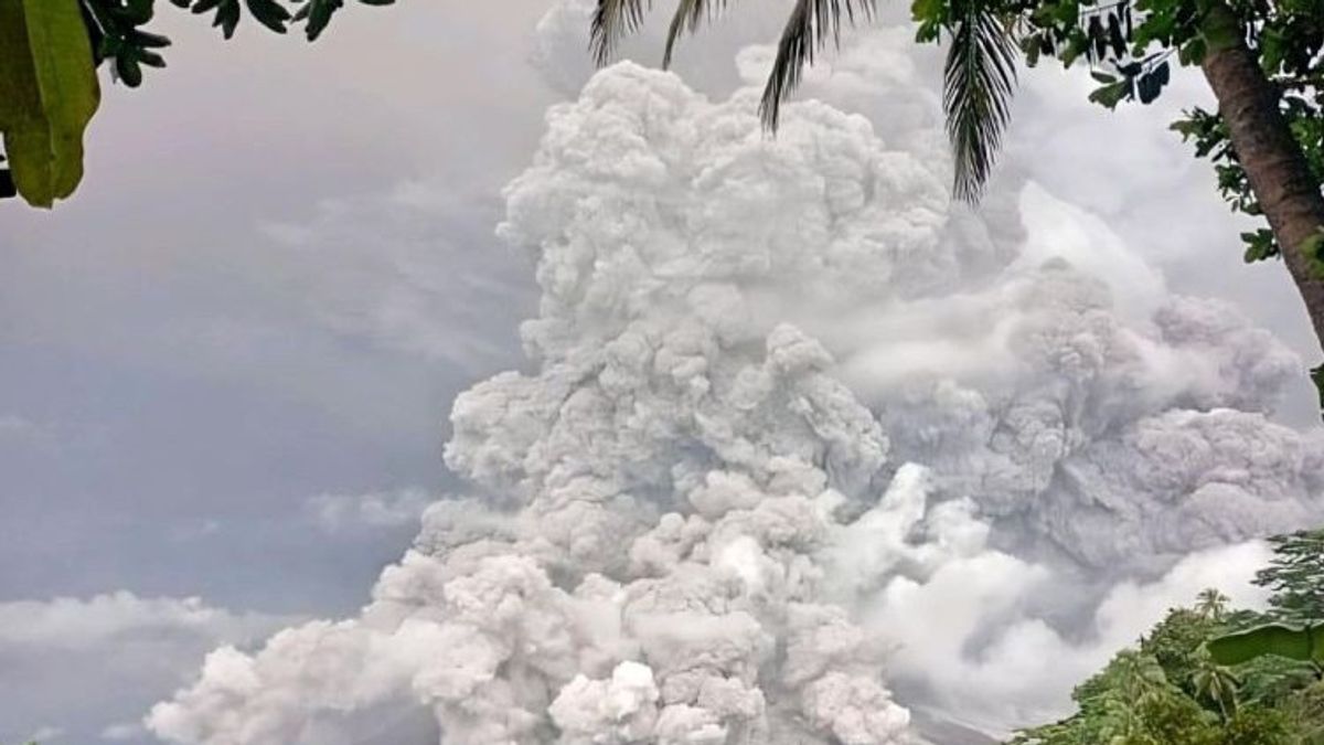
Bumi Madya Investigator Hetty Triastuty said the expansion of the recommendation distance was carried out due to volcanic activity that occurred in the form of hot clouds, rock ejections, and ash columns as high as five kilometers at 08.35 WITA.
"We observed the development of Mount Ruang in the early hours of this morning that the eruptive material reached an area that was quite far in radius. So, taking into account that we are turning it back to an improvement in the expansion of seven kilometers," Hetty said at a press conference reported by ANTARA, Tuesday, April 30.
On April 30, 2024 at 01.30 WITAPVMBG again raised the status of Mount Ruang from the previous Alert to Alert in line with the increase in volcanic activity and seismicity in the volcano.
PVMBG asks residents around Mount Ruang not to enter a radius of seven kilometers from the center of the active crater of Mount Ruang. Meanwhile, residents who live in the Tamulandang Island area who are included in the recommended distance should immediately be evacuated to a safe place outside the seven-kilometer radius.
There are two villages on Ruang Island, namely Limpatehe and Pumpente Villages. The location of the two villages is only 2.5 kilometers from the top of Mount Ruang.
SEE ALSO:


The entire population of the two villages has been evacuated to a safe place so that they avoid the danger of eruptions and hot clouds. The safe zone for evacuation is on Tamulandang Island, which is next to Ruang Island with a distance of about 10 kilometers from the crater center.
Mount Ruang has a peak height of 725 meters above sea level and at the same time forms a separate island from another island.
The mountain, which is type strato with the lava dome, is administratively located in Tulusan Village, Tagulandang District, Sitaro Islands Regency and PVMBG, observing visual and instrumental activity from the Volcano Observation Post (PGA) located in the area.
The English, Chinese, Japanese, Arabic, and French versions are automatically generated by the AI. So there may still be inaccuracies in translating, please always see Indonesian as our main language. (system supported by DigitalSiber.id)
Most Popular Tags
#Prabowo Subianto #donald trump #2026 World Cup #venezuela #konflik timur tengahPopular


