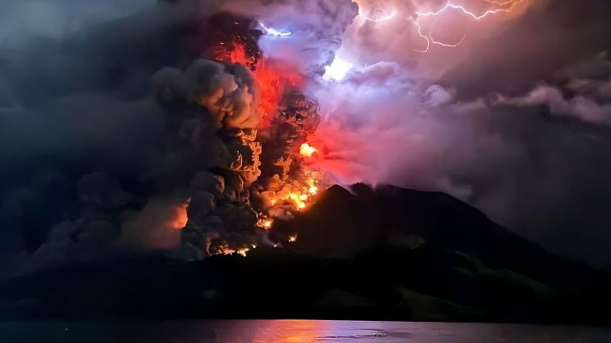


The Center for Volcanology and Geological Hazard Mitigation (PVMBG) issued a tsunami warning after the attack of explosive eruptions accompanied by hot clouds occurred on Mount Ruang in Sitaro Regency, North Sulawesi.
"People on the island of Tamulandang, especially those living near the beach, should be aware of the potential for incandescent rock, hot clouds, and tsunamis caused by the collapse of the volcano's body into the sea," said PVMBG Head Hendra Gunawan as reported by ANTARA, Wednesday, April 17.
PVMBG data states that during the last 24 hours there has been five eruptions with an altitude of 1,800 meters to 3,000 meters from the top of Mount Ruang.
The explosive eruption caused rumbling sounds, earthquakes, and volcanic lightning.
In the period 1-17 April 2024, PVMBG recorded 1,439 earthquakes on Mount Ruang, 569 shallow volcanic earthquakes, six local tectonic earthquakes, and 167 distant tectonic earthquakes.
The earthquake was recorded four times on the MMI scale. The number of seismicities, especially deep volcanic earthquakes that occurred in the period 1-17 April 2024, showed a significant increase compared to March 2024.
Hendra revealed that after increasing the level of activity to Alert (level II) on April 16, 2024 at 13.00 WITA, and Alert (level III) on April 16, 2024 at 16.00 WITA, visual activity and seismicity showed a significant increase.
SEE ALSO:
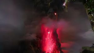

The height of the eruption column tends to increase with the eruptive material in the form of ash accompanied by the ejection of incandescent rocks which reaches a distance of about five kilometers on Tagulandang Island.
The number of incidents of volcanic earthquakes increased significantly accompanied by volcanic tremors with amplitudes ofdooverscale, which indicates that currently there is still a rock mapping process accompanied by magma migration from deep magma reservoirs to the surface in the form of explosive eruptions surrounding the effusive eruption ( lava flow).
PVMBG asked the community around Mount Ruang to remain vigilant and not enter a radius of six kilometers from the center of the active crater of the strato-type volcano.
"People who live in the Tagulandang Island area which is within a six-kilometer radius should be immediately evacuated to a safe place outside a six-kilometer radius," concluded PVMBG Head Hendra Gunawan.
The English, Chinese, Japanese, Arabic, and French versions are automatically generated by the AI. So there may still be inaccuracies in translating, please always see Indonesian as our main language. (system supported by DigitalSiber.id)
Most Popular Tags
#Prabowo Subianto #donald trump #2026 World Cup #venezuela #konflik timur tengahPopular


