

JAKARTA - The Meteorology, Climatology and Geophysics Agency (BMKG) stated that the presence of tropical cyclones in the northern region of West Papua and west of Bengkulu caused extreme weather conditions in the majority of major cities in Indonesia.
"Indonesia's surface wind is generally dominated from northeast to east with velocities ranging from 10 to 50 kilometers per hour," said BMKG forecaster Nurul Izzah Fitria in her statement, Tuesday 16 April. She explained the cyclonic circulation in the Pacific Ocean north of the West Papua region and the Indian Ocean west of the Bengkulu region forming an elongated convergence area in the northern Pacific Ocean of Papua from Papua Mountains to Papua. Then, from West Papua to Teluk Cenderawasih, from Aceh to West Sumatra, Riau Islands, the northern waters of the Bangka Belitung Islands to South Sumatra. The weather phenomenon also forms a confluency area on the central, northern part of Sumatra, Southwest Papua, and the Arafuru Sea. "These conditions are able to increase the potential growth of rain clouds along the cyclonic circulation area of such convergence and convergence," said Nurul. He explained the weather forecast on the island of Sumatra today the majority has the potential to experience thunderstorms. The areas that need to be watched out for thunderstorms are Medan, Pekanbaru, Padang, Pangkal Pinang, and Bengkulu.The weather is in the form of light to moderately predicted rain in Banda Aceh, Banda Lampung, Jambi, and Palembang. On the island of Java, BKMG predicts light to moderate rain in Serang, Semarang, Surabaya, and Bandung. Cloudy skies only have the potential to occur in Jakarta and Yogyakarta. In the Sunda Islands, light and moderate rain has the potential to occur in Denpasar and Mataram, while, cloudy weather is expected to OVERshadow the Kupang mainland. Weather forecasts that vary on the island of Kalimantan. Light to moderate rains have the potential to occur in Samarinda, Banjarmasin, and Palangkaraya, while thunderstorms in Pontianak and are cloudy in Tanjung Selor. On Sulawesi Island, cloudy sky is expected to occur in Gorontalo and Manado, light rain has the potential to fall down Palu, Makassar, and Kendari, while heavy rains in Mamujur. Nul said that the weather in eastern regions of Indonesia is quite conducy in the sky is cloudy
SEE ALSO:
-
 | BERITA
Jumlah Korban Longsor Tana Toraja Bertambah, 20 Korban Meninggal Ditemukan
16 April 2024, 06:27 -
 | TEKNOLOGI
Grup Penipuan Blockchain Pindahkan Rp16 Miliar ke Blast untuk Skema Baru
16 April 2024, 06:06 -
 | OLAHRAGA
Dua Kartu Merah Timnas Indonesia U-23 Dipertanyakan saat Kalah 2-0 dari Qatar
16 April 2024, 01:00
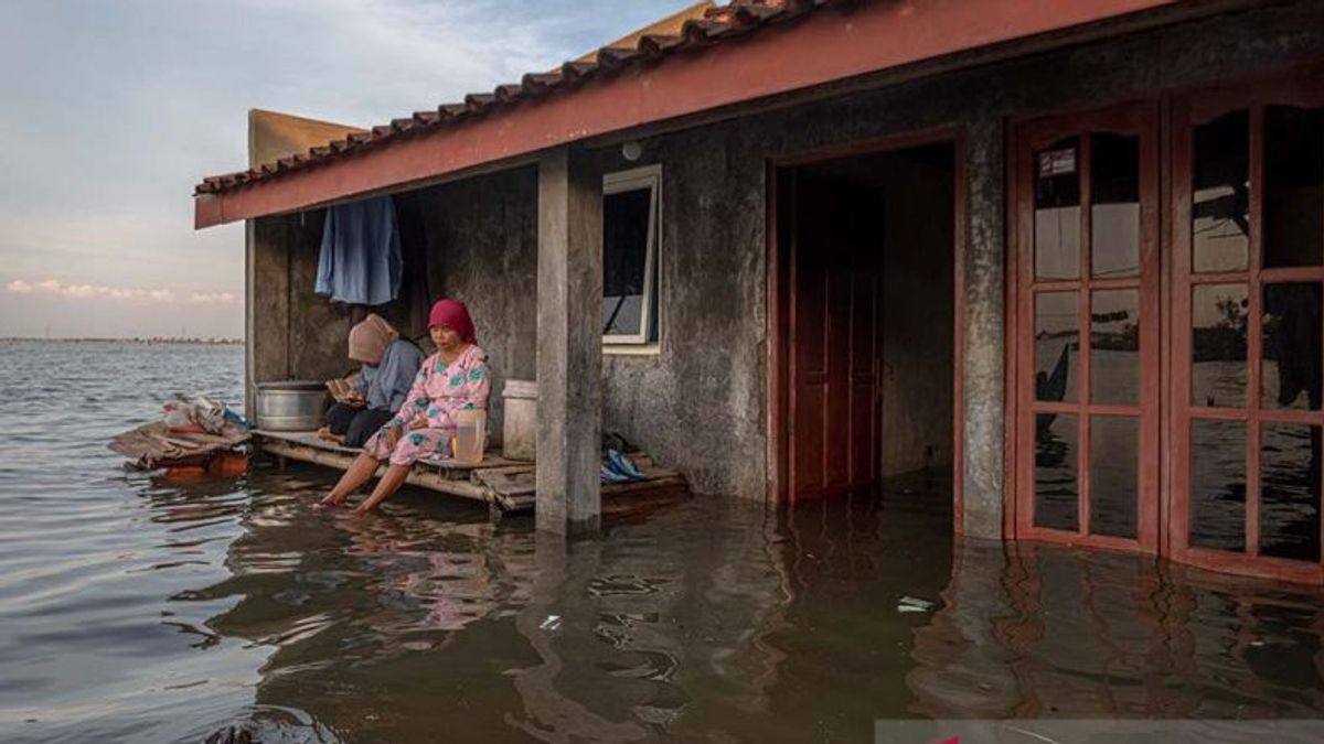
The air temperature ranges from 19 to 35 degrees Celsius with humidity ranging from 55 to 100 percent. The forecast for sea wave heights in Indonesia is generally quite conducive, ranging from 0.5 to 2.5 meters. "However, it is necessary to be aware of the potential for tidal flooding on the north coast of Central Java," said BMKG forecaster Nurul Izzah Fitria.
The English, Chinese, Japanese, Arabic, and French versions are automatically generated by the AI. So there may still be inaccuracies in translating, please always see Indonesian as our main language. (system supported by DigitalSiber.id)
Most Popular Tags
#Prabowo Subianto #donald trump #Febrie Adriansyah #8791 #giias 2026Popular


