

MALUKU - The activity of Mount Gamalama in Ternate City has increased since yesterday, Thursday, January 4. There were dozens of Deep Volcanic Earthquakes (VA) on the mountain whose status is now Level II.
Head of the Center for Volcanology and Geological Hazard Mitigation, Hendra Gunawan, explained that his party recorded 45 Internal Volcanic Earthquakes with an amplitude of 4-46 mm on January 4, 2024 from 00.00-06.00 WIT.
This increase in the Deep Volcanic Earthquake shows an increase in pressure within Mount Gamalama due to increased magmatic activity.
Meanwhile, the surface has not been recorded.
Hendra continued, from December 1, 2023 to January 3, 2024, 34 earthquakes were recorded, 57 earthquakes were deep volcanic earthquakes, 55 local tectonic earthquakes, 359 distant tectonic earthquakes, and six flood tremors.
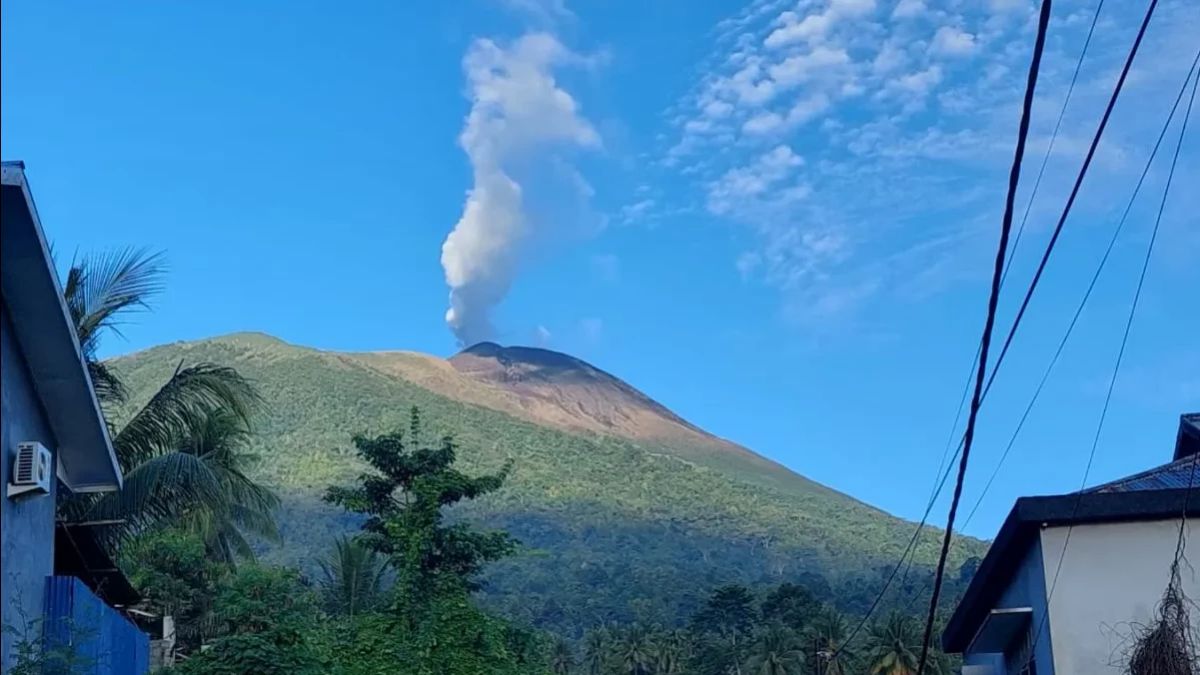
In fact, the activity of crater gusts from December 1, 2023 to January 3, 2024, was observed by gusts of thin white crater smoke with a height of 10 - 120 meters.
Weak-fast winds to the north, northeast, east, southeast, south, southwest, and northwest.
However, in general, the activity of Mount Gamalama from December 1, 2023 to January 4, 2024 at 06.00 WIT tends to fluctuate and is still dominated by deep volcanic earthquakes, local tectonic earthquakes, and distant tectonic earthquakes related to regional tectonic activity around the Halmahera archipelago.
In this condition, and given the caraceristic precursor of the eruption of Mount Gamalama, the potential danger that is likely to occur is the Freatic Eruption with a threat of danger for now in the form of material ejection from the main crater hitting the area with a radius of 1.5 km from the eruption center.
SEE ALSO:
-
 | BERITA
Tanggapi Program Susu Gratis Prabowo-Gibran, Mahfud: Yang Kecil-kecil Saja Impor
05 Januari 2024, 17:01 -
 | BERITA
Hai Kids, Gibran Pakai AI Menyapa Anak-anak Indonesia Janjikan Masa Depan Cerah
05 Januari 2024, 14:24


Thin ash rain can occur with distance and intensity depending on the direction and speed of the wind.
Therefore, Hendra appealed to the people around Mount Gamalama and visitors/tourists not to move within a 1.5 km radius of the main crater at the peak of Mount Gamalama.
Pada musim hujan, masyarakat yang tinggal di sekitar aliran sungai yang berahulu di kawasan puncak Gunung Gamalama untuk selalu meningkatkan kewasiatan terhadap potensi ancaman bahaya se secondari berupa aliran lahar.
The mountain, which has a height of 1715 m above sea level, is an active volcano that has recorded history of erupting since 1538 with an eruption interval of between 1-50 years.
Mount Gamalama is monitored visually and instrumentally from the Volcano Observation Post (PGA) located at Facei Saba, Ternate City.
The English, Chinese, Japanese, Arabic, and French versions are automatically generated by the AI. So there may still be inaccuracies in translating, please always see Indonesian as our main language. (system supported by DigitalSiber.id)


