

JAKARTA - A rare map of the Korean Peninsula dating back to the 19th century has been returned to South Korea from Japan.
The Cultural Heritage Administration (CHA) on Thursday launched "Daedongyeojido," which was previously owned by a Japanese collector.
Officials from the Korea Cultural Heritage Foundation Abroad flew to the country to examine the condition of the relic and negotiate a deal for its return.
In March, the Korean government bought it with lottery funds and brought it back to Korea. The price was not disclosed, citing confidentiality.
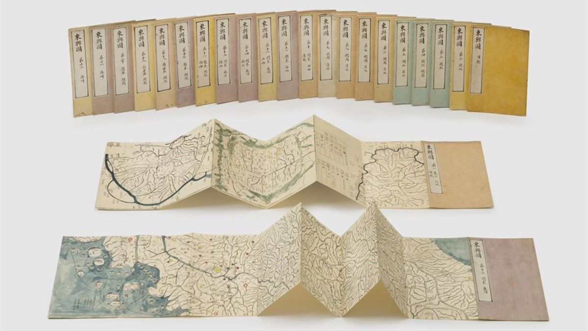
"Daedongyeojido", which translates as "the Great East territorial map," was first created by cartographer Kim Jeong-ho in 1861 during the Joseon Kingdom (1392-1910).
This map was republished in 1864 in the form of 22 foldable buckets. This map was very important at its time, as it was one of the first efforts in a comprehensive Korean mapping, describing all administrative divisions, physical features, and villages in the country in great detail.
The map returned is a printed edition of a wooden block produced in 1864. The map is colorful and contains a handwritten "gapil," or revision. It also contains geographic information from "Dongyeodo," another atlas featuring geographic information from Korea in the Joseon era, including 1,800 traffic routes, military facilities, and location names.
Unlike Dongyeodo, which translates as "East State ATlas", Daedongyeojido removes many names of places and areas because of difficulties in carving wood blocks.
The edition returned from Japan is the first known example to compensate for Daedongyeojido's limitations which were printed with wooden blocks by copying annotations from Dongyeodo.
"The repatriated Daedongyeojido presents a different format and content compared to other editions in the Korean collection, so Daedongyeojido's return from Japan has an important meaning," a CHA official said, as reported by the Korea Times March 31.
The Daedongyeojido edition consists of 23buklet - 22 for the map and one for the map list. The format follows the Dongyeodo format.
SEE ALSO:
-
 | BERITA
Ilmuwan Dunia Luncuran Misi Pencarian 100 Ribu Spesies Bawah Laut Baru
29 April 2023, 22:15 -
 | BERITA
Usai Jalani Restorasi, 30 Makam Bersejarah di Istanbul Kembali Dibuka untuk Umum
29 April 2023, 19:15


For example, the second bucket, which depicts Mount Paektu and its surrounding area, shows a distance between military and stone warnings that marked the border at the time with China, a feature that was not present in the Daedongyeojido edition printed with a wooden block.
In the 14thbuklet, which describes Ulleung Island in the East Sea and its surrounding areas, was written a departure point for ships bound for the island. This was not found in the other Daedongyeojido edition.
"The rediscovered Daedongyeojido will provide materials for research, on the production and use of maps during the Joseon Kingdom. This will also expand the scope of research on the geographical information of the Joseon era as a printed edition of the first wooden beam with transcriptional annotations from Dongyeodo that have been identified to date," said CHA official.
The English, Chinese, Japanese, Arabic, and French versions are automatically generated by the AI. So there may still be inaccuracies in translating, please always see Indonesian as our main language. (system supported by DigitalSiber.id)
Most Popular Tags
#Prabowo Subianto #donald trump #2026 World Cup #venezuela #konflik timur tengahPopular


