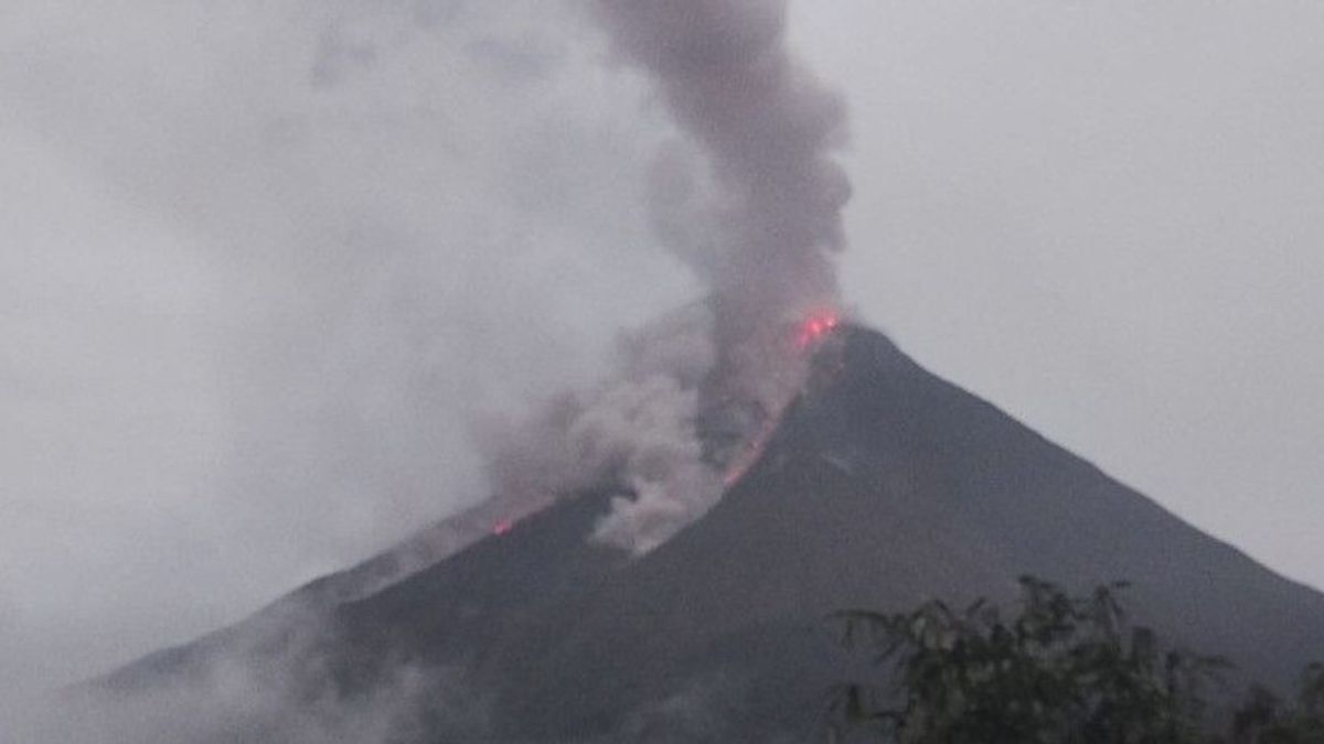
MANADO - The Karangetang Volcano Observation Post recorded the activity of lava avalanches from Mount Karangetang in Sitaro Islands Regency, North Sulawesi, until now still high after the eruption a few days ago.
"This is indicated by wisps of thin to slightly thick clouds of grayish-white and brownish smoke that extend in the lava flow," said Head of the Karangetang Volcano Observation Post (PPGA) Yudia Prama Tatipang quoted by ANTARA, Wednesday, February 22.
Yudia said the lava avalanches from the top of the main crater of Mount Karangetang to Kali Batuawang and Kahetang were approximately 750 to 1,500 meters. Meanwhile, the lava flows to the Batang River around 750 to 1,800 meters, then to Timbelang and West Beha Rivers approximately 750 to 1,500 meters.
Visually, Yudia added, the crater smoke with weak to moderate pressure was observed to be white with light to medium intensity and a height of 150 meters above the top of the crater.
One distant tectonic earthquake was recorded with an amplitude of 15 millimeters, S-P: 25 seconds with a duration of 78 seconds. Continuous tremors (microtremor) were recorded with an amplitude of 3-7 millimeters (3 millimeters dominant).
"The seismogram is dominated by avalanches. Until now, the status of Mount Karangetang is still on alert level III," he said.
SEE ALSO:
Yudia hopes the public will continue to follow the recommendations issued by the Center for Volcanology and Geological Hazard Mitigation (PVMBG) of the Geological Agency of the Ministry of Energy and Mineral Resources to avoid unwanted things.
Until now, as many as 28 heads of families who live in Kulu and Kola-Kola, Bebali Village, East Siau District, Sitaro Islands Regency, North Sulawesi, are still being evacuated after the eruption of Mount Karangetang a few days ago.
The English, Chinese, Japanese, Arabic, and French versions are automatically generated by the AI. So there may still be inaccuracies in translating, please always see Indonesian as our main language. (system supported by DigitalSiber.id)
