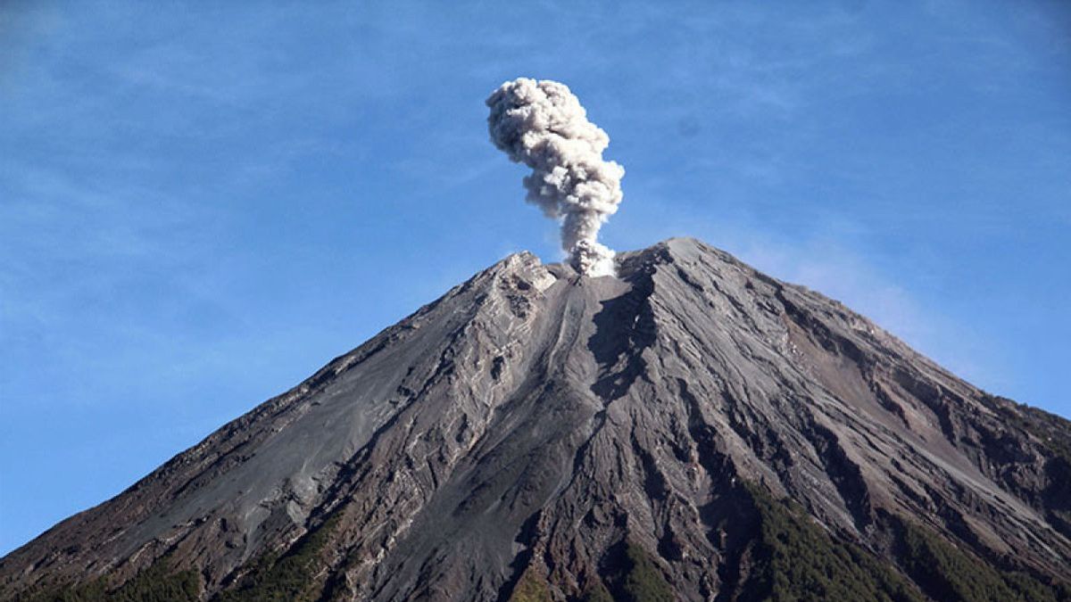


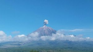
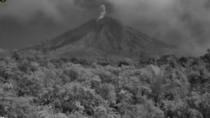
JAKARTA - The Geological Agency of the Ministry of Energy and Mineral Resources explained the current conditions of Mount Semeru's activities. Where, on Thursday, March 28 at 15.18 WIB experienced an eruption in the form of hot clouds.
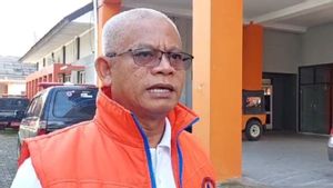
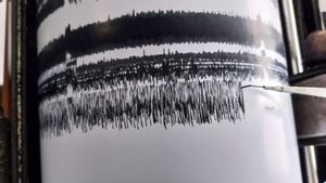
"The eruption in the form of a hot cloud with a sliding distance and an eruption ash column height is unknown and because the visual of Mount Semeru is covered in fog, but a seismogram with a maximum amplitude of 37 mm and a duration of 27 minutes is recorded," said Head of the Geological Agency of the Ministry of Energy and Mineral Resources (ESDM) Muhammad Wafid quoting Antara.
According to him, the activity of Mount Semeru shows that eruption activity, hot clouds, and lava avalanches are still happening, but visually rarely being observed due to foggy weather constraints.
"In addition to the potential for clouds to occur, the potential for lava flows is still high considering the high rainfall on Mount Semeru," he said.
He explained that the accumulation of eruptive material (cuts and lava flows) as well as the formation of "soria cones" has the potential to become incandescent lava avalanches or hot clouds.
The material for lava avalanches or hot clouds that have been deposited along the river that originates at the top of Mount Semeru has the potential to become lava when interacting with rainwater.
"In addition, the interaction of lava avalanche material deposits or hot clouds with high temperature with river water will have the potential for secondary eruptions," he said.
During that period, the number of recorded earthquakes showed that the seismic activity of Mount Semeru was still high, especially earthquake eruptions, avalanches, and harmonics.
Internal volcanic and harmonic earthquakes that are still recorded indicate that there is still supply below the Semeru surface along with the release of material to the surface, as well as the process of buildup of eruptive materials around the Jonggring Saloko crater.
"Based on the results of the analysis and evaluation, the level of activity of Mount Semeru remains at level III (Alert) with recommendations that are adjusted to the latest potential hazards," he said.
SEE ALSO:
For this reason, it is recommended that people do not carry out any activities in the southeast sector along Besuk Kobokan, as far as 13 km from the summit (the center of the eruption).
Beyond that distance, people are not allowed to carry out activities at a distance of 500 meters from the riverbank (river border) along Besuk Kobokan because it has the potential to be affected by the expansion of hot clouds and lava flows up to a distance of 17 km from the summit.
Residents are prohibited from doing activities within a 5 km radius of the crater/peak of Mount Semeru because they are prone to the danger of throwing stones (pijar).
The public is also asked to be aware of the potential for hot clouds, lava avalanches, and lahars along rivers/valleys that originate at the peak of the Semeru Volcano, especially along Besuk Kobokan, Besuk Bang, Besuk Kembar, and Besuk Sat as well as the potential for lahars in small rivers that are tributaries of Besuk Kobokan.
The English, Chinese, Japanese, Arabic, and French versions are automatically generated by the AI. So there may still be inaccuracies in translating, please always see Indonesian as our main language. (system supported by DigitalSiber.id)
Most Popular Tags
#Prabowo Subianto #earthquake #Constitutional Court #Palestine #Indonesian National teamPopular
Related News