

JAKARTA - The Regional Disaster Management Agency (BPBD) has mapped a number of areas in the Special Region of Yogyakarta (DIY) which have the most potential to experience landslides when entering the rainy season.
Head of BPBD DIY Noviar Rahmad said the mapping was carried out in Kulon Progo, Bantul, Gunungkidul and Sleman Regencies.
"Most of them are Kulon Progo, (the potential for landslides) is the highest," said Noviar after the preparedness meeting against the rainy season at Kenari Field, Yogyakarta, Tuesday, November 21, was confiscated by Antara.
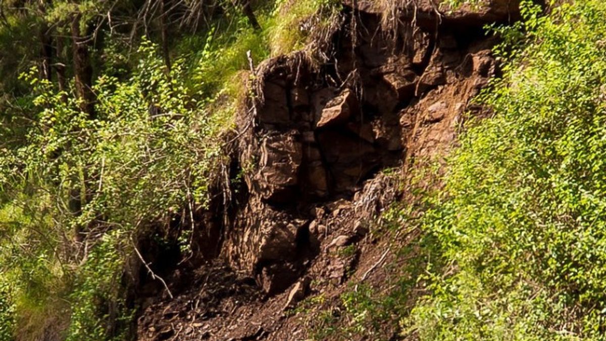
According to him, mapping the potentially landslide area is carried out in line with the large number of soil cracks that arise due to drought throughout the dry season.
"Reversal during drought when heavy rains occur, there will be the potential for landslides," he said.
Therefore, Noviar appealed to the public, especially those living in hilly areas, to immediately find a safe point when they learned of the appearance of cracks in the surrounding soil.
"Landsor is a natural disaster that cannot be predicted, but we can map its potential so that when there is a potential we must immediately avoid it," said Noviar.
According to Noviar, currently, 332 disaster-resilient urban villages have been formed in DIY, each of which has a disaster risk reduction forum (PRB).
Thus, all citizens have received education and understanding of actions that need to be taken when a disaster occurs.
اقرأ أيضا:
-
 | BERITA
Bareskrim Surati Pemprov DKI, Rekomendasi Cabut Izin Usaha KLOUD Sky Dining & Lounge
20 November 2023, 14:41 -
 | BERITA
Ganjar Beri Rapor Merah Penegakan Hukum Era Jokowi, Puan Yakin Berdasarkan Data
20 November 2023, 13:15 -
 | BERITA
Hampir Seratus Saksi dan Ahli Sudah Diperiksa untuk Temukan Tersangka Pemerasan SYL
17 November 2023, 08:33

Through the preparedness meeting for the rainy season, Noviar ensured that all disaster management components in DIY were ready to help the community face potential disasters supported by their equipment.
Meanwhile, Head of the DIY BPBD Emergency Management Division Lilik Andi Aryanto added that the mapping was carried out together with the Geological Disaster Technology Research and Development Center (BPPTKG).
BPPTKG, said Lilik, has mapped the cracks of the soil in the Kulon Progo Regency area, especially in the Menoreh mountains and based on the results, several potential cracks in the mountains were found.
"The steps to overcome the cracks are actually easy, just covered with the surrounding soil. So by covering the same land, it will be safe," he said.
In addition to the Menoreh Mountains, according to him, mapping was also carried out in Gunungkidul Regency because previously there had been landslides in Semin District.
"According to information from BPBD friends, Gunungkidul Regency has been closed so that hopefully it is safe," he said.
Lilik ensured that the entire landslide potential area was far from residential areas.
The English, Chinese, Japanese, Arabic, and French versions are automatically generated by the AI. So there may still be inaccuracies in translating, please always see Indonesian as our main language. (system supported by DigitalSiber.id)
العلامات الأكثر شيوعًا
#Prabowo Subianto #جولكار #انتخابات جاكرتا #المقامرة عبر الإنترنت #Mount Lewotobi maleجمع