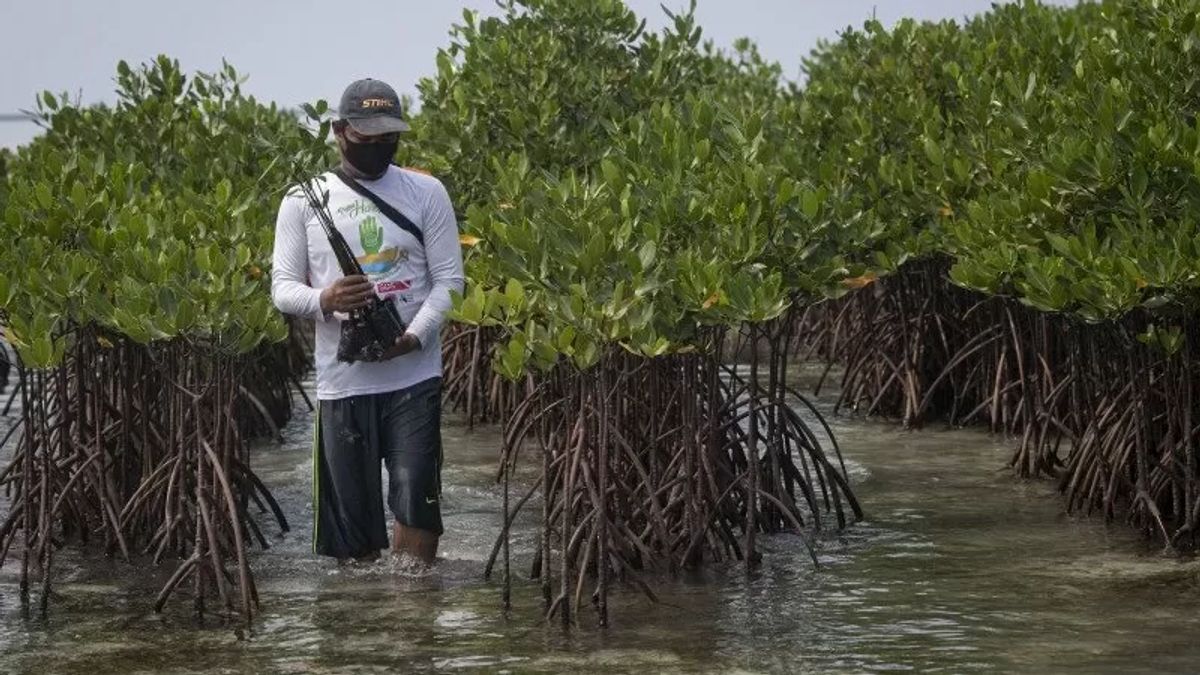
LAMPUNG - The Lampung Regional Police (Polda) arrested a perpetrator who carried out destruction of mangroves or mangroves located in the coastal area of Bandar Lampung City.
"The arrest of Harsono was because he was not cooperative when clarification and case report (BAP) was carried out at the investigation and investigation stage, so an attempt was made to arrest the suspect in the Ujung Kulon area, Pandeglang Regency, Banten," said Head of Sub-Directorate IV Tipidter Ditreskrimsus Lampung Police AKBP Yusriandi, in South Lampung, Wednesday, July 26, confiscated by Antara.
He said, based on the suspect's statement, the mangrove forest felling located on Jalan Teluk Bone, Teluk Betung Timur District, was to seek profit by turning it into a shrimp farming pond.
"The evidence that has been secured by investigators is a tool in the form of an iron rod at the ends of a four-sided iron plate that is used to dig mud in the mangrove ecosystem, one hoe, one 12-inch paralon pipe with a length of about 1.5 meters and two used logging mangrove logs," he said.
He emphasized that to provide legal certainty, the Lampung Police took steps to handle the case completely until P21 (complete).
"Until now, the process of investigating the case file is in the research stage of the Lampung High Prosecutor's Office (phase I)," he said.
He revealed that the prosecution of the perpetrators of the destruction of mangrove forests in Bandar Lampung began with the Lampung Environmental Wahana (WALHI) report regarding logging activities in the mangrove ecosystem in that location.
"Actually, the local community and related parties have taken preventive measures by reprimanding the person concerned, but Harsono did not heed this, even though he had made a statement not to carry out the activity again," he said.
اقرأ أيضا:
So, in March 2023 the incident was reported by WALHI to the Lampung Regional Police and followed up by Sub-Directorate IV Tipiter Ditreskrimsus.
Then, Lampung Police investigators together with a team from the Lampung Provincial Marine and Fisheries Service conducted field checks for coordinate collection.
"The result at the logging location is a mangrove conservation zone area. Then at the location there are traces of a spine that is suspected to be used as a mangrove tree cutting with an area of around + 2,500m2, which has been in the form of two maps of fish or shrimp farming ponds and there is also a hut," he said.
The English, Chinese, Japanese, Arabic, and French versions are automatically generated by the AI. So there may still be inaccuracies in translating, please always see Indonesian as our main language. (system supported by DigitalSiber.id)
