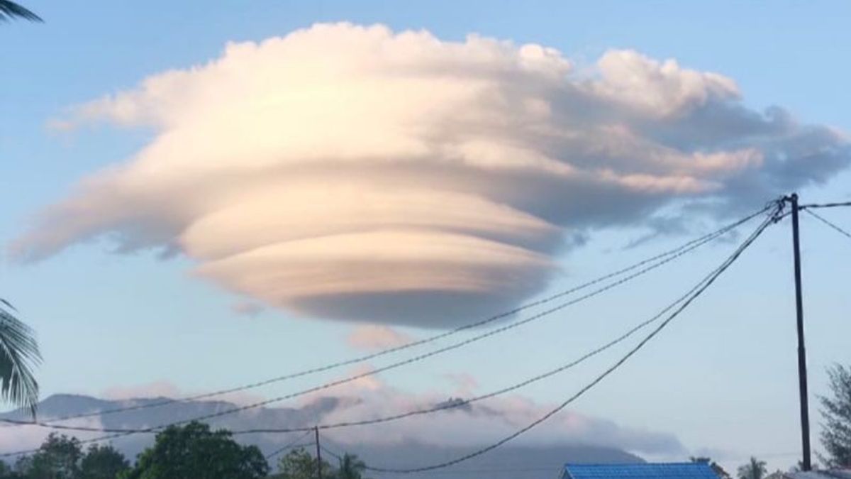
NATUNA - The Regional Disaster Management Agency (BPBD) confirmed the appearance of rare clouds in the sky of Ranai, Natuna Regency, Riau Islands Province (Kepri), on Sunday (7/5) afternoon until evening.
"The phenomenon of rare clouds occurs at around 15.00 WWIBib, until the evening. However, this morning there are no more," said Head of Emergency and Logistics Division of BPBD Natuna, Zulheppy, as reported by ANTARA, Monday, May 8.
He said the vortex-shaped clouds could be clearly observed from residential areas in Ranai, so many of them captured the rare moment with cell phones and were broadcast to various social media platforms.
"This photo and cloud video went viral on social media. Moreover, this is the first time this has happened in Natuna," said Zulheppy.
Meanwhile, the BMKG Ranai Forcer, Reza Pahlevi, conveyed that the phenomenon that occurred in the sky in the area was quite rare.
"This cloud is a Lenticularis cloud or commonly called a cloud of hats," said Reza.
According to him, these clouds are usually formed by mountain waves triggered by strong winds that blow from one side of the mountain.
The thickness of the horizontally moving wind passes through the mountain wall, causing deflection that forms mountain waves to occur on the other side of the mountain.
"Lenticularis clouds show strong vertical turbulence or wind. So it is dangerous for low flights around the clouds," he said.
اقرأ أيضا:
Reza said the Lenticularis clouds began to form when the wind currents flowing parallel to the surface of the earth encountered obstacles from certain objects, such as mountains. As a result of these obstacles, the air current rises perpendicular to the top of the clouds.
When the air rises a lot, it contains water vapor and is stable. When the temperature of the dew points is reached at the top of the mountain, water vapor begins to condense into clouds that follow the top contour of the mountain. When air flows down from the top of the mountain, the condensation process stops.
"Therefore, the Lenticularis clouds did not seem to move, because the clouds began to form from the wind direction to the top of the mountain, and then disappeared to the bottom of the wind," said Reza.
The English, Chinese, Japanese, Arabic, and French versions are automatically generated by the AI. So there may still be inaccuracies in translating, please always see Indonesian as our main language. (system supported by DigitalSiber.id)


