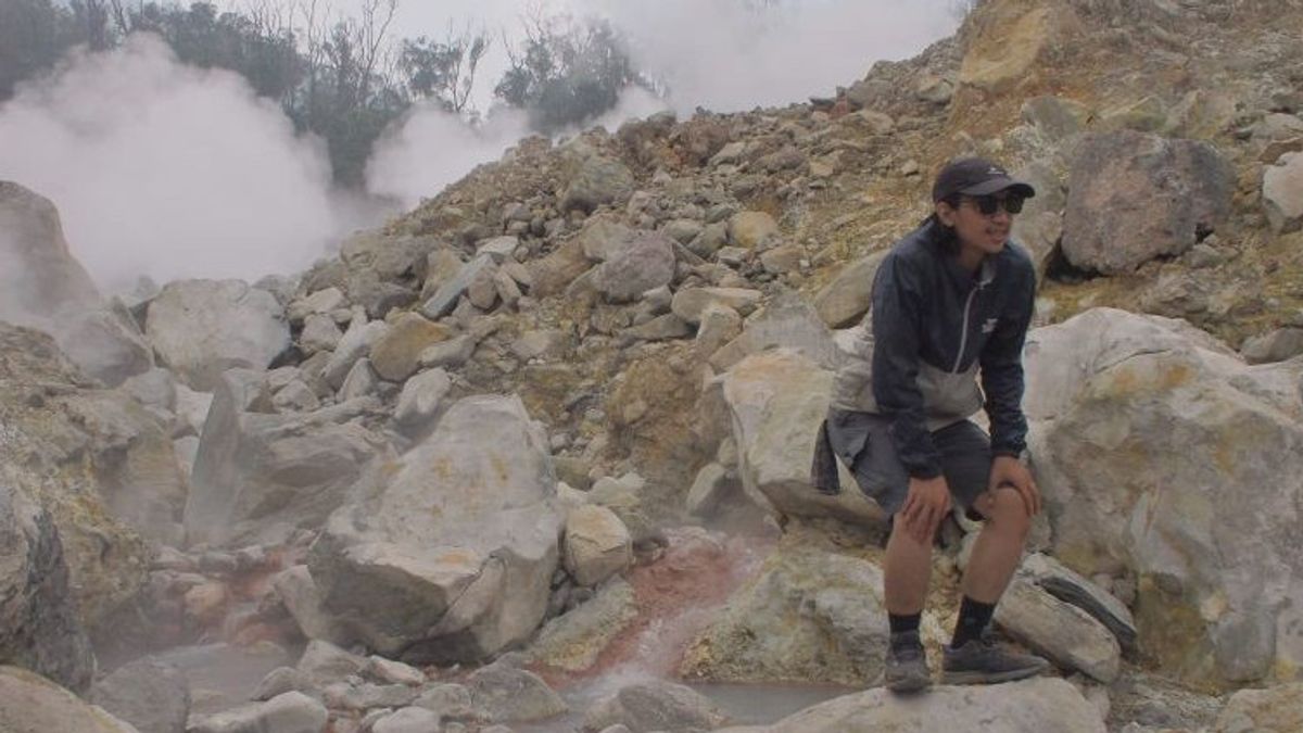


BOGOR - The Center for Mount Halimun Salak National Park (TN) temporarily closed the Mount Salak climbing route, after an earthquake measuring 4.6 magnitudes centered in Sukabumi Regency, West Java.
Head of the TN Center, Erlan Sodahlan, revealed that the closure was carried out on December 15, 2023, until an undetermined time.
"Starting December 15, 2023, it will be temporarily closed for climbing Puncak Salak and Ratu Crater," he said as quoted by ANTARA, Thursday, December 15.
The closure of the hiking trail is stated in Circular Number SE.4722/T.14/TU/KSA.3.1/12/2023 from the Head of the TN Office. The decision was issued on December 8, 2023.
In the circular, there are two reasons why the Mount Salak and Ratu Crater climbing routes are closed. The first is to restore forest ecosystems on climbing routes that are routine at the end of the year until the beginning of the new year.
In addition, the recent extreme weather is also a consideration for the closure of this hiking trail. This is because the intensity of rain is fairly high in December.
"Every end of the year we are used to closing the hiking trail. The reason is because of extreme weather and in the context of restoring the forest ecosystem around the hiking trail," said Erlan.
Meanwhile, Bogor Regent Iwan Setiawan appealed to the community around the foot of Mount Salak to increase their vigilance after being shaken by the earthquake in the past week twice.
"We ask and appeal to people whose houses are located at the foot of the mountain to be vigilant," said Iwan.
The Bogor Regency BPBD will also conduct a study on which areas in Bogor Regency are included in the foot span of Mount Salak and are prone to earthquakes.
The first earthquake natural disaster occurred in the early hours of Friday (8/12) in Purwabakti Village, Pamijahan, Bogor Regency, which damaged 77 houses and two places of worship.
Then, the latest on Thursday (14/12) morning, an earthquake again occurred measuring 4.6 magnitudes centered in Sukabumi Regency. This earthquake, based on temporary data from the Bogor Regency Regional Disaster Management Agency (BPBD), damaged 61 houses.
Dozens of houses affected by the earthquake were spread across four sub-districts, namely Pamijahan, Luewiliang, Nanggung, and Ciampea.
Until now, the Bogor Regency BPBD is still conducting a rapid assessment of the impact of the earthquake that occurred on Thursday (14/12) that morning.
관련 항목:
-
 | BERITA
Sekjen Gerindra Anggap Aksi Gibran ‘Kompori’ Pendukung Bersorak Hanya Ekspresi
14 Desember 2023, 20:44 -
 | BERITA
Densus 88 Tangkap 9 Tersangka Teroris JI di Jawa Tengah, Sita 6 Senpi Hingga Ratusan Amunisi
14 Desember 2023, 18:41 -
 | BERITA
Alexander Marwata Batal Jadi Saksi Meringankan Firli Bahuri di Bareskrim Hari Ini
14 Desember 2023, 18:36 -
 | BERITA
Mahfud soal Nasib Pengungsi Rohingya: Masih Cari Tempat Penampungan Sementara
14 Desember 2023, 18:08

Previously, the Head of the Disaster Data, Information and Communication Center of the National Disaster Management Agency (BNPB) Abdul Muhari reported that an earthquake with a magnitude (M) of 4.6 rocked the Sukabumi Regency, which occurred on Thursday (14/12) at 06.35 WIB.
BMKG noted that the epicenter of the earthquake was on land 25 kilometers northwest of Sukabumi Regency with a depth of 5 kilometers.
The locations affected by the earthquake in Bogor Regency are Pamijahan, Leuwiliang, Nanggung, and Ciampea Districts. Furthermore, the locations affected by the earthquake in Sukabumi Regency, namely Kabandungan, Kalapanunggal, Kadudampi, and Cikembar Districts.*
The English, Chinese, Japanese, Arabic, and French versions are automatically generated by the AI. So there may still be inaccuracies in translating, please always see Indonesian as our main language. (system supported by DigitalSiber.id)