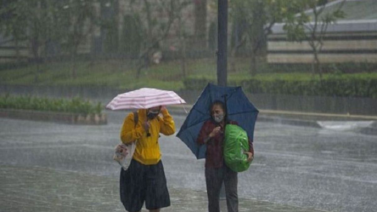


JAKARTA - The National Research and Innovation Agency (BRIN) has analyzed the rain that flushed the Jabodetabek area a few days ago triggered by the emergence of Tropical Cyclone Saola in the Philippines.
"The storm is strong enough to draw water vapor from the south of Java Island. The stronger the storm, the stronger the water vapor will be drawn towards the Philippines," said BRIN Researcher at the Center for Climate and Atmospheric Research, Eddy Hermawan, as reported by ANTARA, Wednesday, August 30.
Tropical Cyclone Saola has a maximum wind speed of 85 knots or the equivalent of 155 kilometers per hour with a minimum air pressure of 955 millibars.
Eddy said the clouds and water vapor that were pulled from the southern waters of Java Island passed through Jakarta, Bogor, Bekasi, Tangerang, and Banten. As a result, it rained in these areas.
According to him, the wind carrying water vapor has a tendency to find a low pressure center.
"(Rain) is only a temporary condition and El Nino still exists," he said.
VOIR éGALEMENT:
-
 | BERITA
Kasus Denny Indrayana Masih Berkutat di Pemeriksaan Saksi, Ini Penjelasan Bareskrim
30 Agustus 2023, 16:28 -
 | BERITA
Rafael Alun Trisambodo Beli Puluhan Tas Mewah Rp1,5 Miliar, Lebih dari Setengahnya KW
30 Agustus 2023, 14:46 -
 | BERITA
Caleg Eks Koruptor Ditantang Deklarasi ‘Saya Mantan Napi Korupsi’ di Baliho Kampanye
30 Agustus 2023, 13:39

BRIN said there are three factors that can reduce El Nino's strength which triggers a longer dry season, namely the Asian monsoon, the Indian Ocean Dipole (IOD), and the Madden'Julian Oscillation (MJO) in the Indian Ocean.
Currently, he said, the three phenomena have not emerged because they are still below the surface.
"El Nino, who appeared in May 2023, will reach normal or neutral conditions in March, April, and May 2024 or almost one year," said Eddy.
The English, Chinese, Japanese, Arabic, and French versions are automatically generated by the AI. So there may still be inaccuracies in translating, please always see Indonesian as our main language. (system supported by DigitalSiber.id)
Tags les plus populaires
#Prabowo Subianto #Golkar #OTT KPK #élections jakarta #jeux d’argent en lignePopulaire