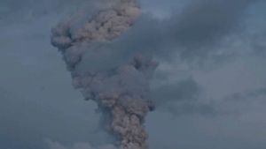


LUMAJANG - Mount Semeru, which is on the border of Lumajang Regency and Malang, East Java, has erupted again with an eruption height of up to 700 meters above the peak or around 4,376 meters above sea level.
"Mount Semeru erupted on February 1, 2023, at 07.29 WIB. The height of the eruption column was observed around 700 meters above the peak", said Mount Semeru Observation Post official Sigit Rian Alfian in a written statement quoted by ANTARA, Wednesday, February 1.
According to him, the ash column was observed to be white to grey with a thick intensity to the northeast and the eruption was recorded on a seismograph with a maximum amplitude of 22 mm and a duration of 80 seconds.
Meanwhile, the Head of Emergency, Rehabilitation and Reconstruction of the Lumajang Regional Disaster Management Agency (BPBD) Joko Sambang said that his party had received a report from officials from the Mount Semeru Observation Post.
"Visually, during the observation period 1 February 2023 at 06.00-12.00 WIB, 19 eruptions were observed with a height of 500-700 meters and the colour of grey smoke", he said.
Mount Semeru is clearly visible until it is foggy, then the crater smoke is observed to be white and grey with moderate to thick intensity and a height of 300-700 meters above the top of the crater.
VOIR éGALEMENT:
-
 | BERITA
Kompol D Selingkuh dengan Nur Penumpang Audi A6, Kompolnas: Sanksi Etik dan Pidana
01 Februari 2023, 09:29 -
 | BERITA
KPK: 76 Tersangka Ditahan di Rutan, Dapat Fasilitas Makan hingga Olahraga
01 Februari 2023, 10:16

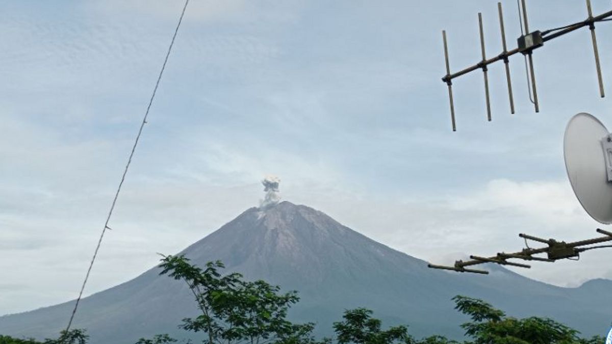
"The eruption of the mountain which had an altitude of 3,676 meters above sea level was accompanied by a weak to moderate rumble. Mount Semeru is on standby or Level III status", he said.
Seismic activity recorded 19 eruptions with an amplitude of 15-23 mm, three eruptions with an amplitude of 8-10 mm, and one distant tectonic eruption with an amplitude of 29 mm.
Joko said the public was urged to comply with the recommendations of the Center for Volcanology and Geological Hazard Mitigation (PVMBG) in line with Mount Semeru's alert status.
"The community is advised not to carry out any activities in the southeastern sector along Besuk Kobokan as far as 13 km from the peak (the eruption centre)", he said.
Outside of this distance, the community does not carry out activities at a distance of 500 meters from the riverbank (river border) along Besuk Kobokan because it has the potential to be affected by the expansion of hot clouds and lava flows up to a distance of 17 km from the summit.
"The community is also prohibited from doing activities within a 5 km radius from the crater/top of Mount Semeru because it is prone to the danger of throwing stones (incandescent)", he said.
The public is also asked to be aware of the potential for hot cloud avalanches (APG), lava avalanches, and lava along rivers/valleys that disgorge at the top of Mount Semeru, especially along Besuk Kobokan, Besuk Bang, Besuk Kembar, and Besuk Sat as well as the potential for lava in rivers. -a small river which is a tributary of Besuk Kobokan.
The English, Chinese, Japanese, Arabic, and French versions are automatically generated by the AI. So there may still be inaccuracies in translating, please always see Indonesian as our main language. (system supported by DigitalSiber.id)