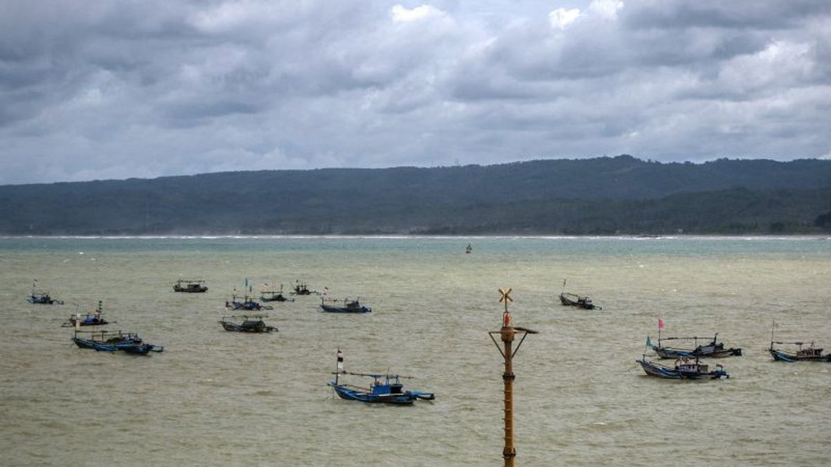


JAKARTA - The Meteorology, Climatology and Geophysics Agency (BMKG) issued an early warning of the potential for high waves in 24 Indonesian territorial waters.
The high waves are expected to occur from Thursday, August 25 morning to Friday August 26 at 07.00 WIB.
Based on BMKG data obtained from Antara on Thursday, August 25, areas of water with very high waves are predicted to occur in the West Indian Ocean of Aceh. With an estimated wave height of 4 meters.
Meanwhile, waters that will experience high waves of about 2.5 meters to 4 meters are predicted to occur in the North Waters of Sabang; Aceh's West Waters; the western waters of Simeulue Island to the Mentawai Islands; Bengkulu waters to West Lampung; West Indian Ocean from Nias to Lampung.
Then, the western and southern parts of the Sunda Strait; the Southern Waters of Java; Southern waters of Bali to Sumbawa; Bali Strait - Lombok - Southern Alas; the Southern Waters of Sumba Island; the waters of Sawu Island to Kupang, Rote Island; Southern Sawu Sea; South Indian Ocean, Banten to NTT.
the waters of Manui to Kendari East; Southern Banggai waters; Eastern Tolo Bay; Wakatobi Waters; the waters of the southern part of Buru-Ambon-Seram Island; Banda Sea; the southern waters of the Sermata Islands to the Tanimbar Islands; Southern waters of the Kai Islands to Aru; and the waters of the Arafuru Sea.
Meanwhile, other areas of Indonesian waters are predicted to experience moderate waves of around 1.25 meters to 2.5 meters.
VOIR éGALEMENT:
-
 | BERITA
PKS DKI Ngotot Anies Jadi Capres, Cawapresnya Tergantung Kesepakatan Koalisi
24 Agustus 2022, 09:58 -
 | BERITA
Parpol Terus Bersikap Pragmatis, Pengamat Nilai Koalisi Pemilu 2024 Masih Cair
24 Agustus 2022, 07:59 -
 | BERITA
Pemerintah Bakal Menaikkan Lagi Harga BBM Subsidi, PKS: Emak-emak Makin Menjerit!
24 Agustus 2022, 10:31

The English, Chinese, Japanese, Arabic, and French versions are automatically generated by the AI. So there may still be inaccuracies in translating, please always see Indonesian as our main language. (system supported by DigitalSiber.id)
Tags les plus populaires
#Prabowo Subianto #Nouvel An #Syrie #nataru #NatalPopulaire