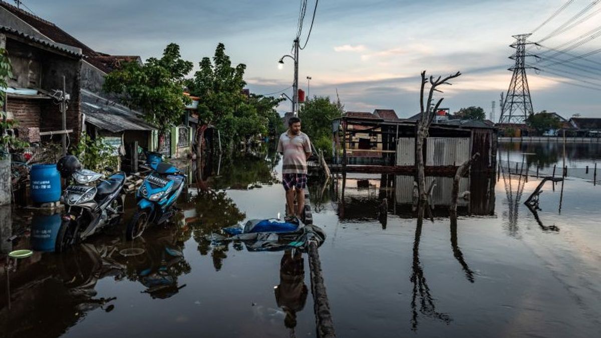


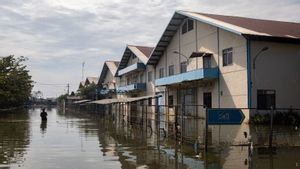
JAKARTA - Secretary of the Geological Agency who is also Acting Head of the Center for Marine Geological Survey and Mapping, Ediar Usman, said that tidal flooding or high tides hit several areas of the North Coast of Java (Pantura), which is expected to continue throughout June.
Therefore, the public is advised to be careful, especially when they are on the beach. Environmental arrangements and drainage can also offset the potential for high tides and puddles during the rainy season.
"If we look at the climatic conditions, as stated by BMKG, that season like this might last until June. So there is still the potential for tidal flooding until June. Therefore, we are advised to be careful, especially on the shoreline. On the coast there was a sudden rise in sea level and that of course also endangers all of us," Ediar said in a statement to the media, Wednesday, June 1.
The public is also advised to follow directions from the local regional government, especially the regional and central disaster management agencies such as the BMKG, BNPB and also the geological agency, which can be seen on the website and social media of the geological agency.
Ediar also recommended that tidal flood mitigation efforts be carried out in a more integrated manner by understanding geological and oceanographic conditions, as well as coastal dynamics.
VOIR éGALEMENT:


"The common perception and coordination between relevant agencies and all elements of society are also needed to find optimal solutions. The mindset and lifestyle of the local community must apply a clean lifestyle in their respective environments and be able to adapt to the environment. City space in the coastal area is well-organized for residential areas, industry, ports, tourism, fishing and fisheries," said Ediar.
For information, Physiographically the city of Semarang and other cities located on alluvial plains is the result of sediment originating from the highlands as a result of transportation through rivers and waves in coastal areas.
The sediments in this alluvial plain originate from the North Serayu Mountains in the south, and are bounded by the Kendeng hills in the east and face the Java Sea in the north. Coastal areas are characterized by alluvial deposits, mud, mangrove plants, sandy and rocky beaches referred to as marine sediments.
From the results of field investigations conducted by the Center for Research and Development of Marine Geology/Marine Geological Survey and Mapping Center (BBSPGL) shows that in general the development and use of land in Pantura, Central Java currently causes unconsolidated sediments to experience consolidation (compaction), but in certain areas (settlements) the decline is, of course, faster because there is a load on it, so that compaction occurs faster.
"So in addition to occurring naturally, the presence of buildings on it will accelerate land subsidence in the north coast under high tide conditions," concluded Ediar.
The English, Chinese, Japanese, Arabic, and French versions are automatically generated by the AI. So there may still be inaccuracies in translating, please always see Indonesian as our main language. (system supported by DigitalSiber.id)
Tags les plus populaires
#Prabowo Subianto #Nouvel An #accident d’avion #Hasto Kristiyanto #nataru #squid game 2Populaire