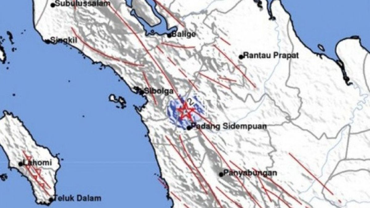


JAKARTA - A tectonic earthquake with a magnitude of 3.4 at a depth of 2 km shook Padang Sidimpuan City, North Sumatra, and surrounding areas on Tuesday at 05.40 WIB
The epicenter was at coordinates 1.53 LU, and 99.24 BT, or precisely located on land at a distance of 8 km Southwest of South Tapanuli, North Sumatra.
Head of BBMKG Region I Medan, Hartanto said by paying attention to the location of the epicenter and the depth of the hypocenter, the earthquake that occurred was a type of shallow earthquake due to active fault activity, sumatra fault system in the Toru Segment.
The impact of the earthquake is illustrated by bmkg shock level map (Shakemap) and based on reports from the community, this earthquake was felt in padang Sidimpuan area with Intensity Scale II MMI (Vibration felt by some people, light objects hung swaying.).
However, until now there have been no reports of damage to buildings as a result of the earthquake.
Until 06.30 WIB, bmkg monitoring results, have not shown any aftershock activity.
The community is encouraged to remain calm and unaffected by unaccountable issues. As reported by Antara, Tuesday, May 18.
Make sure the official information is only sourced from BMKG which is disseminated through verified official communication channels (Instagram/Twitter @infoBMKG), website (http://www.bmkg.go.id or inatews.bmkg.go.id).), or through Mobile Apps (IOS and Android): wrs-bmkg or infobmkg.
The English, Chinese, Japanese, Arabic, and French versions are automatically generated by the AI. So there may still be inaccuracies in translating, please always see Indonesian as our main language. (system supported by DigitalSiber.id)
Most Popular Tags
#Prabowo Subianto #donald trump #Febrie Adriansyah #8791 #giias 2026Popular


