


JAKARTA - The Meteorology, Climatology and Geophysics Agency (BMKG) issued an early warning regarding the emergence of 96S tropical cyclone seeds which are expected to have an impact on extreme weather in several areas of East Nusa Tenggara (NTT), especially on April 13 to 15, 2025.
BMKG forecaster for Class II Meteorological Station El Tari Kupang, Riris Eliza Helen, said that the chance for these cyclone seeds to develop into tropical cyclones within 24 hours is quite significant, in the medium to high category.
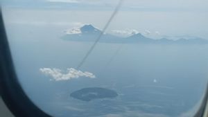
According to the latest data, the seeds of tropical cyclone 96S were observed in the southeastern region of NTT, precisely around coordinates 12.5 degrees South Latitude and 125.9 degrees East Longitude. The maximum recorded wind speed reaches 30 knots or about 60 kilometers per hour, with minimum air pressure at 1002 hPa.
BMKG estimates that these cyclone seeds will continue to develop slowly and move towards the south to the southwest, approaching the Timor Sea to the southeast of Rote Island, adjacent to Australia's northern waters.
SEE ALSO:


The atmospheric conditions affected by this system have the potential to cause bad weather in the form of moderate to heavy rain, accompanied by lightning and strong winds in various areas of NTT.
In addition, the presence of active atmospheric Kelvin waves in the area further strengthens the potential for heavy rain accompanied by other weather disturbances.
BMKG also appealed to the public to remain alert to the possibility of hydrometeorological disasters such as floods, landslides, and tornadoes that could occur due to this extreme weather.
Currently, most areas of East Nusa Tenggara are also in the transition period from the rainy season to the dry season, which is generally marked by more uncertain weather.
The English, Chinese, Japanese, Arabic, and French versions are automatically generated by the AI. So there may still be inaccuracies in translating, please always see Indonesian as our main language. (system supported by DigitalSiber.id)
Most Popular Tags
#Prabowo Subianto #donald trump #2026 World Cup #Febrie Adriansyah #8791Popular


