JAKARTA - The Regional Disaster Management Agency (BPBD) of Lumajang, East Java appealed to the public to be aware of the increase in earthquake activity of Mount Lamongan which has a height of 1,651 meters above sea level (masl) in the local district.
"We are still monitoring the activities of Mount Lamongan in line with its increasing seismic activity," said Head of Emergency and Logistics Division of BPBD Lumajang Yudi Cahyono when confirmed by Antara per telephone in Lumajang, Saturday night.
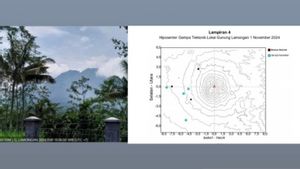
The Center for Volcanology and Geological Hazard Mitigation (PVMBG) of the Geological Agency of the Ministry of Energy and Mineral Resources (ESDM) reported a significant increase in local tectonic earthquakes at the Mount Lamongan complex in a press release published on November 2, 2024.
"We will socialize the PVMBG information to the public and appeal to residents around the foot of Mount Lamongan to be aware of earthquake shocks due to active fault movement," he said.
In addition, he continued, BPBD Lumajang also appealed to climbers climbing Mount Lamongan to coordinate with related parties to anticipate unwanted things in line with the increase in local tectonic earthquake activity.
SEE ALSO:
Meanwhile, Head of the Geological Agency Muhammad Wafid in a press release said that PVMBG recorded the seismic network of Mount Lamongan recording local tectonic earthquakes 13 times in August, 9 times in September, and 19 times in October 2024.
On November 1, 2024, there was an increase in the incidence of local tectonic earthquakes to reach 63 times and the earthquake occurred with a magnitude of duration (Md) between 0.5-2.5-2.5.4.
"Based on the results of visual and instrumental monitoring, Mount Lamongan's volcanic activity is still at Level I (Normal), but the public is asked to be aware of earthquake shocks due to active fault activity that has the potential to cause ground cracks," he said.
He explained that the latest developments in the activity of Mount Lamongan for the period 1 October-1 November 2024 showed the volcano was clearly visible until it was covered in fog. The crater smoke was not observed. The weather is clear to rain, the wind is weak to strong to the north and east.
"The earthquake of Mount Lamongan consists of 82 local tectonic earthquakes with an amplitude of 7-45 mm, a S-P of 1.5-36 seconds and an earthquake length of 13-62.26 seconds, and 38 distant tectonic earthquakes," he said.
Regarding the potential that may arise due to the increase in seismicity, Wafid said the potential danger at this time was in the form of earthquake shocks due to the movement of active faults in the Lamongan Mount complex which could cause ground cracks.
The last eruption of Mount Lamongan occurred in February 1898 in the form of a devastating eruption at a point that produces a new hill (Gunung Anyar). After that, activities in the Mount Lamongan complex were in the form of increasing local seismic activity which caused ground cracks that occurred in 1925, 1978, 1985, 1988, 1989, 1991, 2005, and 2012.
The English, Chinese, Japanese, Arabic, and French versions are automatically generated by the AI. So there may still be inaccuracies in translating, please always see Indonesian as our main language. (system supported by DigitalSiber.id)


